MyTopo
Curtis Station Mississippi US Topo Map
Couldn't load pickup availability
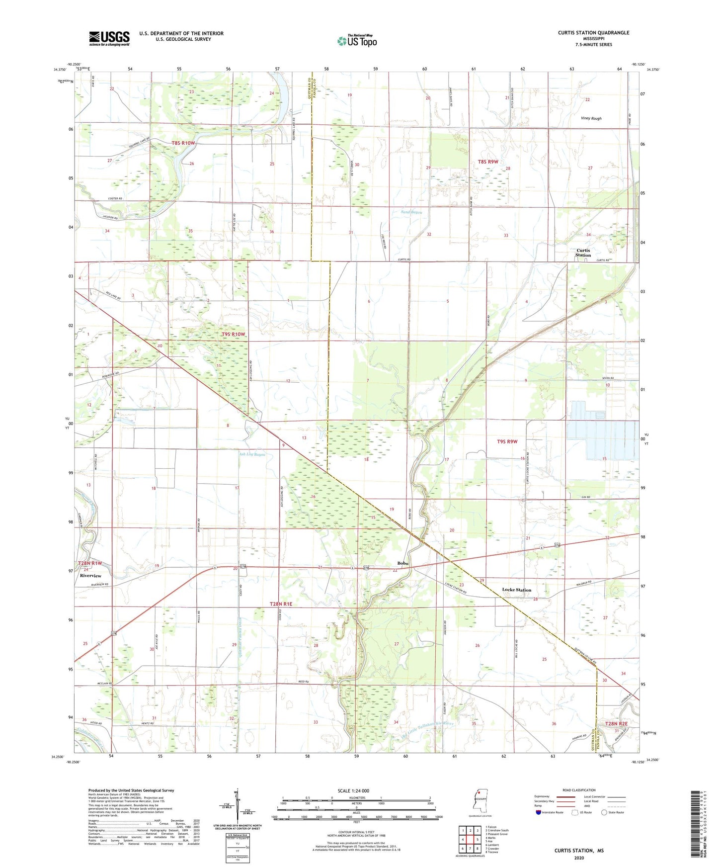
2024 topographic map quadrangle Curtis Station in the state of Mississippi. Scale: 1:24000. Based on the newly updated USGS 7.5' US Topo map series, this map is in the following counties: Quitman, Panola. The map contains contour data, water features, and other items you are used to seeing on USGS maps, but also has updated roads and other features. This is the next generation of topographic maps. Printed on high-quality waterproof paper with UV fade-resistant inks.
Quads adjacent to this one:
West: Marks
Northwest: Falcon
North: Crenshaw South
Northeast: Pleasant Grove
East: Asa
Southeast: Tocowa
South: Crowder
Southwest: Lambert
This map covers the same area as the classic USGS quad with code o34090c2.
Contains the following named places: Ash Log Bayou, Beech Bayou, Blue Hole, Bobo, Curtis Station, Goodwill Church, Lake Carrier, Lake Carrier School, Locke Station, Locke Station Church, Lower Tallahatchie River Y-10-35 Dam, M and M Fish Farm Lake Dam, McDonald Grove Church, Mount Olive Church, Mount Olive School, New Bethel Church, New Bethel School, New Home Church, Onemile Bayou, Pilgrims Rest Church, Queen Chapel, Quitman Panola Ditch, Red Lake, Riverview, Riverview Church, Riverview School, Round Hole, Saint John Church, Sanctified Church, Sand Bayou, Shelton Grove Church, South Lake, Squirrel Lake, Supervisor District 3, Viney Rough, Wesley Chapel