MyTopo
Whitten Town Mississippi US Topo Map
Couldn't load pickup availability
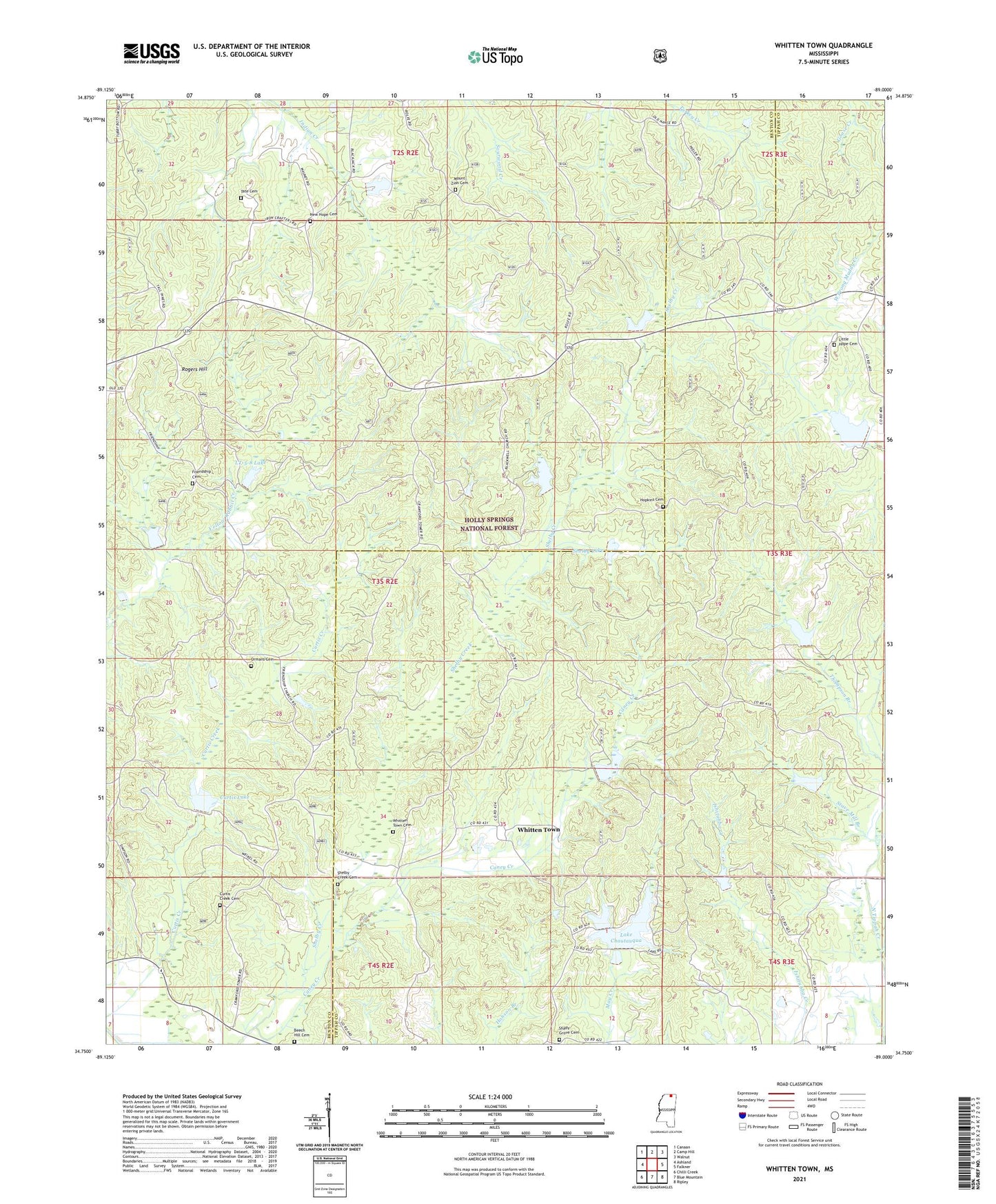
2021 topographic map quadrangle Whitten Town in the state of Mississippi. Scale: 1:24000. Based on the newly updated USGS 7.5' US Topo map series, this map is in the following counties: Benton, Tippah. The map contains contour data, water features, and other items you are used to seeing on USGS maps, but also has updated roads and other features. This is the next generation of topographic maps. Printed on high-quality waterproof paper with UV fade-resistant inks.
Quads adjacent to this one:
West: Ashland
Northwest: Canaan
North: Camp Hill
Northeast: Walnut
East: Falkner
Southeast: Ripley
South: Blue Mountain
Southwest: Chilli Creek
Contains the following named places: Beech Hill Cemetery, Beech Hill Church, Blackwell Church, Caney Creek, Crawford Lookout Tower, Curtis Creek Cemetery, Curtis Creek Church, Curtis Lake, Davenport, Floyd, Floyd Lake Dam, Friendship Cemetery, Friendship Church, Hopkins Cemetery, Hunters Chapel, Lake Chautauqua, Lake Edwards Dam, Little Hope Cemetery, Little Hope Church, Little Tippah River LT-7-17 Dam, LT-5-8 Dam, LT-5-8 Lake, LT-6-3 Dam, LT-7-6 Dam, LT-7-6 Lake, Mount Zion Cemetery, Muddy Creek Structure 4 Dam, New Hope Baptist Church, New Hope Cemetery, North Tippah Watershed LT-6a-1 Dam, North Tippah Watershed LT-6a-14 Dam, North Tippah Watershed LT-6a-2 Dam, Old Shelby Church, Ormans Cemetery, Pleasant Ridge, Rogers Hill, Shady Grove Cemetery, Shady Grove Church, Shelby, Shelby Creek Cemetery, Shelby Lake, Spight, Stave Mill Branch, Supervisor District 3, Tate Cemetery, Thompson Branch, Upper Tippah Watershed LT-6-1 Dam, Upper Tippah Watershed LT-6-17 Dam, Upper Tippah Watershed LT-6-2 Dam, Upper Tippah Watershed LT-6-4 Dam, Whitten Town, Whitten Town Cemetery, Yellow Rabbit, Yellow Rabbit Lake, ZIP Code: 38629