MyTopo
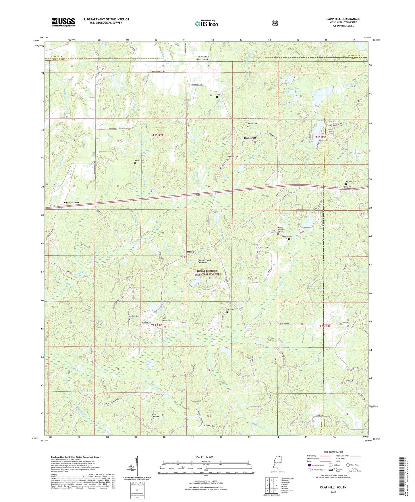
Camp Hill Mississippi US Topo Map
Couldn't load pickup availability
Also explore the Camp Hill Forest Service Topo of this same quad for updated USFS data
2024 topographic map quadrangle Camp Hill in the state of Mississippi. Scale: 1:24000. Based on the newly updated USGS 7.5' US Topo map series, this map is in the following counties: Benton, Tippah, Hardeman. The map contains contour data, water features, and other items you are used to seeing on USGS maps, but also has updated roads and other features. This is the next generation of topographic maps. Printed on high-quality waterproof paper with UV fade-resistant inks.
Quads adjacent to this one:
West: Canaan
Northwest: Grand Junction
North: Saulsbury
Northeast: Middleton
East: Walnut
Southeast: Falkner
South: Whitten Town
Southwest: Ashland
Contains the following named places: Bakers Pond, Benton Lookout Tower, Black Jack, Black Jack Cemetery, Black Jack Church, Brody, Bryant Cemetery, Camp Hill, Camp Hill Cemetery, Goose Creek, Hamilton, Hamilton Cemetery, Hamilton Church, Heathville, Hensley and Glover Cemetery, Hensley Pond, Hines Cemetery, Hines School, Hood Branch, Hopewell, Hopewell Cemetery, Hopewell Presbyterian Church, Indian Creek, Marlow Church, Marlowe Cemetery, McKee Cemetery, Medlock Cemetery, Medlock Church, Mill Branch, Miller Branch, Mount Bethel Church, Mount Pleasant Cemetery, New Barden, New Canaan, Oak Grove School, Sourwood Creek, Turkey Creek, Walnut Lake, Wesley Branch, Wesley Cemetery, Wesley Chapel, Zion Chapel, Zion Chapel Cemetery