MyTopo
Alma Missouri US Topo Map
Couldn't load pickup availability
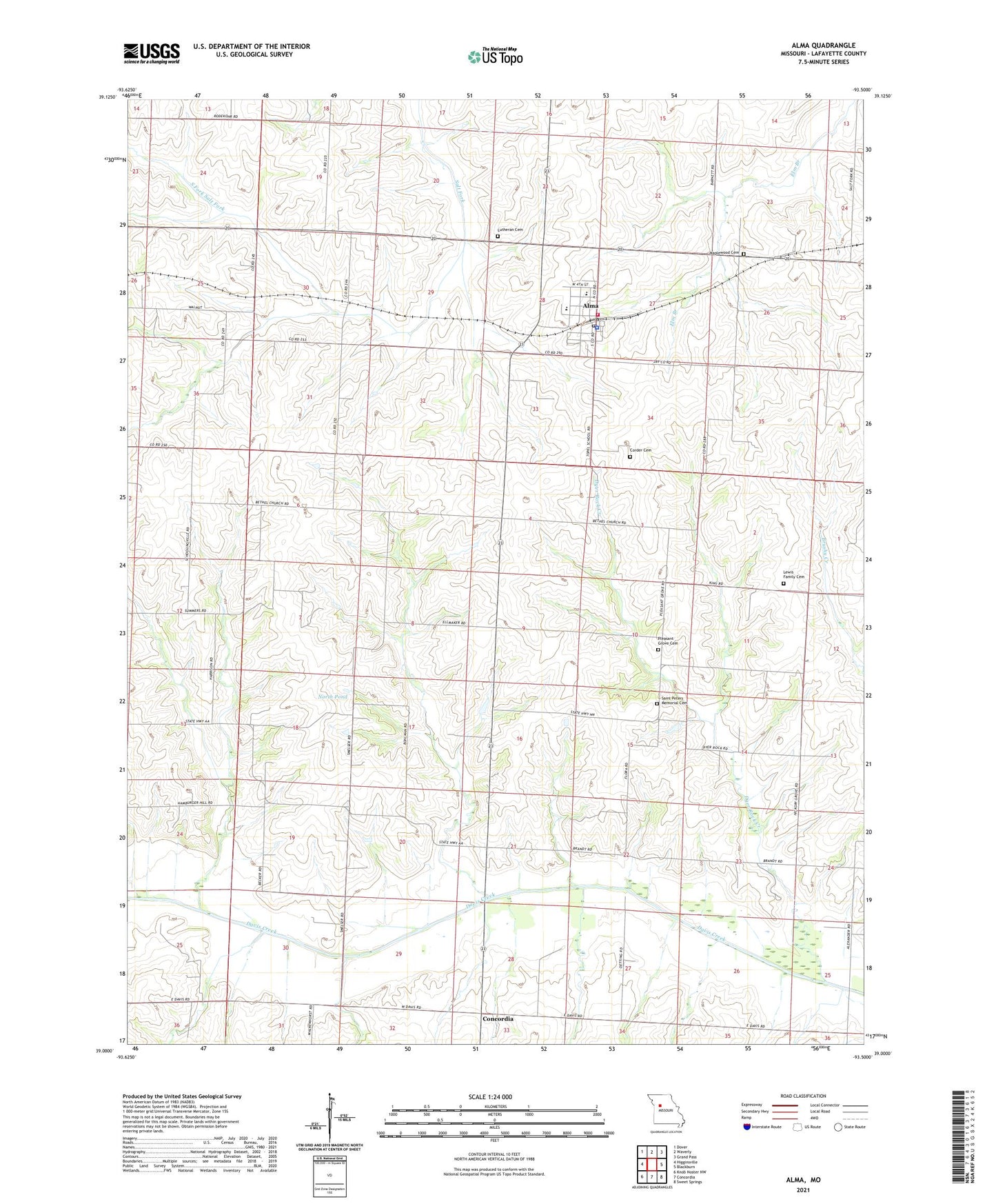
2021 topographic map quadrangle Alma in the state of Missouri. Scale: 1:24000. Based on the newly updated USGS 7.5' US Topo map series, this map is in the following counties: Lafayette. The map contains contour data, water features, and other items you are used to seeing on USGS maps, but also has updated roads and other features. This is the next generation of topographic maps. Printed on high-quality waterproof paper with UV fade-resistant inks.
Quads adjacent to this one:
West: Higginsville
Northwest: Dover
North: Waverly
Northeast: Grand Pass
East: Blackburn
Southeast: Sweet Springs
South: Concordia
Southwest: Knob Noster NW
Contains the following named places: Alma, Alma Fire Protection District, Alma Police Department, Alma Post Office, Brackman School, City of Alma, Corder Cemetery, Davis Lutheran School, Davis School, Dyer Rock Creek, Elk Grove School, Flora School, Hickory Grove School, Lovercamp Lake Dam, Lutheran Cemetery, Maplewood Cemetery, Nienhueser North Lake Dam, Nienhueser South Lake Dam, North Pond, Pleasant Grove Cemetery, Santa Fe High School, Schuette Lake Dam, South Fork Salt Fork, Stockman Lake Dam, Trinity Lutheran School, Wagner Lake Dam, Winters Lake Dam, ZIP Codes: 64001, 64021