MyTopo
Blackburn Missouri US Topo Map
Couldn't load pickup availability
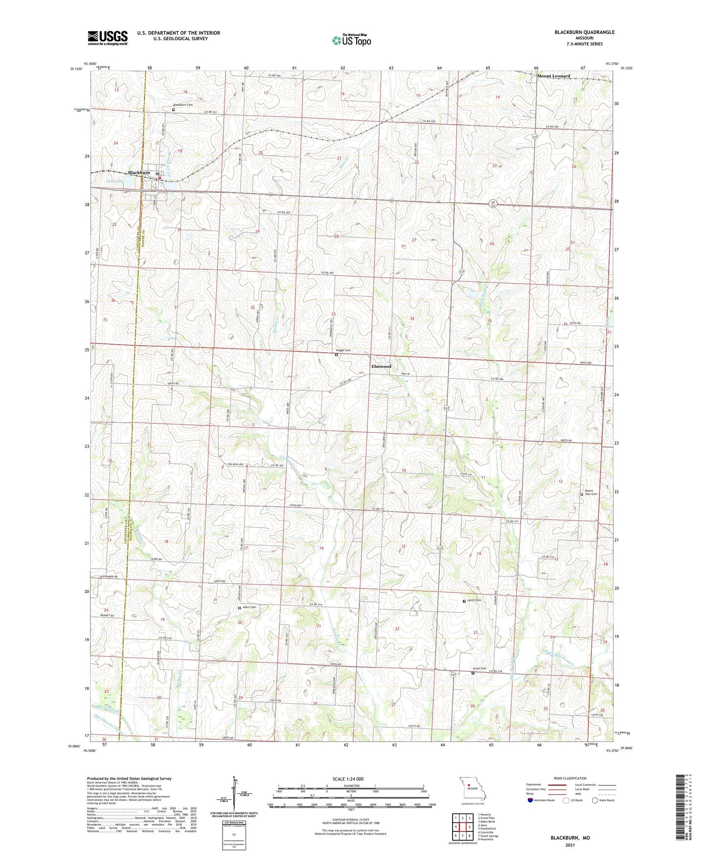
2021 topographic map quadrangle Blackburn in the state of Missouri. Scale: 1:24000. Based on the newly updated USGS 7.5' US Topo map series, this map is in the following counties: Saline, Lafayette. The map contains contour data, water features, and other items you are used to seeing on USGS maps, but also has updated roads and other features. This is the next generation of topographic maps. Printed on high-quality waterproof paper with UV fade-resistant inks.
Quads adjacent to this one:
West: Alma
Northwest: Waverly
North: Grand Pass
Northeast: Malta Bend
East: Shackleford
Southeast: Houstonia
South: Sweet Springs
Southwest: Concordia
This map covers the same area as the classic USGS quad with code o39093a4.
Contains the following named places: Allen Cemetery, Blackburn, Blackburn Cemetery, Blackburn Pond, Blackburn Pond Dam, Blackburn Post Office, Blackburn Rural Fire Protection Association, Carmean School, City of Blackburn, East Fork Salt Pond Creek, Elmwood, Forbes School, Gross Cemetery, Halley School, Kennedy School, Logsdon School, Mount Leonard, Mount Zion School, Pisgah Church, Pony Creek, Prairie View School, Salt Pond Church, Salt Pond School, Stoll Lake, Stoll Lake Dam, Township of Elmwood, ZIP Code: 65321