MyTopo
Grand Pass Missouri US Topo Map
Couldn't load pickup availability
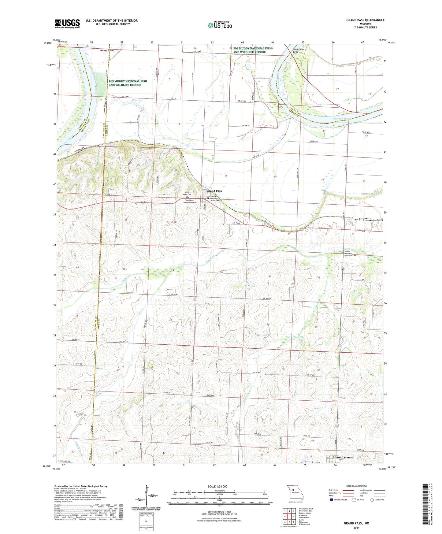
2021 topographic map quadrangle Grand Pass in the state of Missouri. Scale: 1:24000. Based on the newly updated USGS 7.5' US Topo map series, this map is in the following counties: Saline, Lafayette, Carroll. The map contains contour data, water features, and other items you are used to seeing on USGS maps, but also has updated roads and other features. This is the next generation of topographic maps. Printed on high-quality waterproof paper with UV fade-resistant inks.
Quads adjacent to this one:
West: Waverly
Northwest: Carrollton West
North: Carrollton East
Northeast: Miami Station
East: Malta Bend
Southeast: Shackleford
South: Blackburn
Southwest: Alma
This map covers the same area as the classic USGS quad with code o39093b4.
Contains the following named places: East Fork Elm Branch, Elm Branch, Fish Lake, Grand Pass, Grand Pass Methodist Church Cemetery, Little Osage Village, Major School, Mount Nebo Cemetery, Pass Branch, Tamerlane Bend, Town of Mount Leonard, Township of Grand Pass, Village of Grand Pass