MyTopo
Auxvasse Missouri US Topo Map
Couldn't load pickup availability
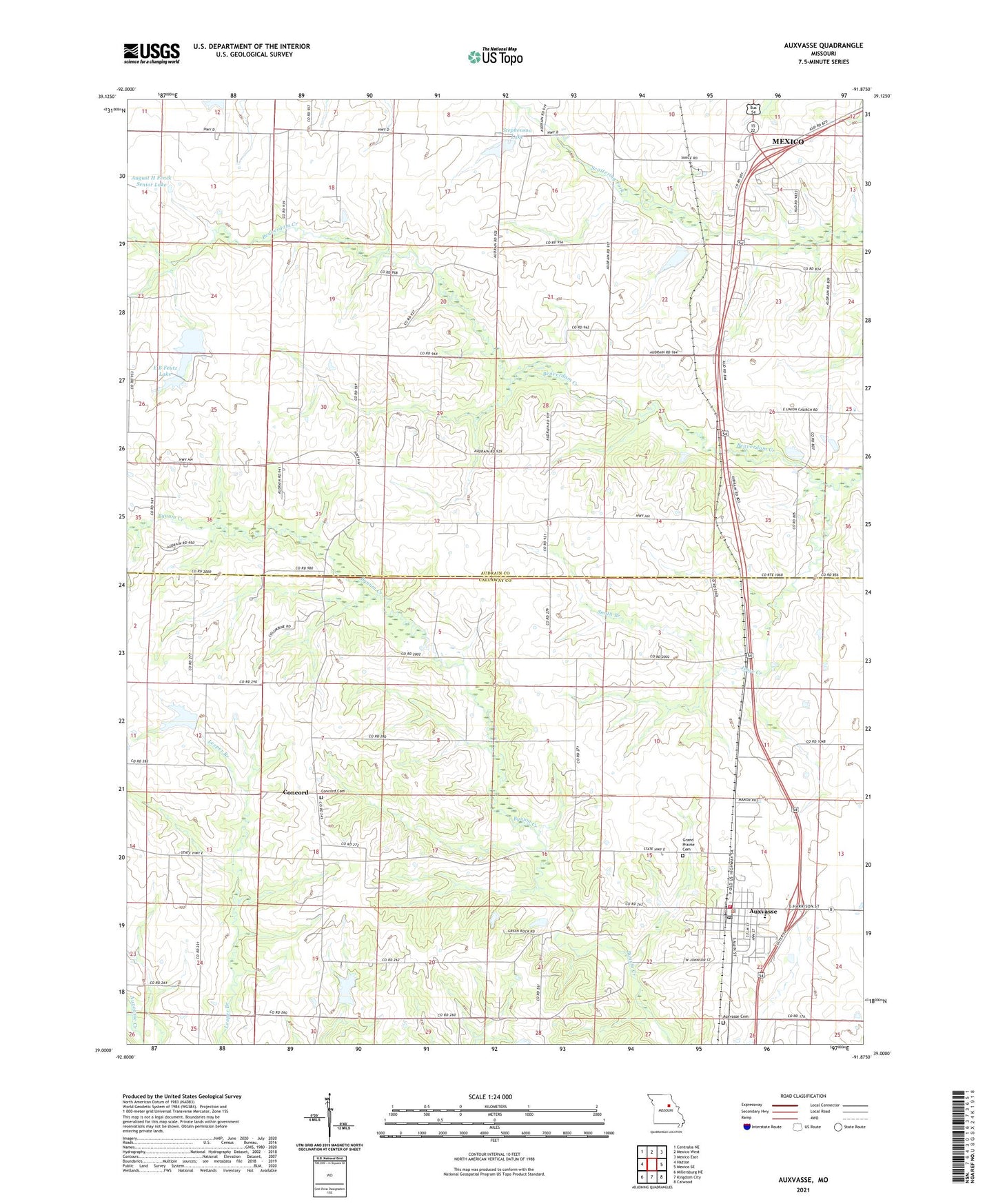
2021 topographic map quadrangle Auxvasse in the state of Missouri. Scale: 1:24000. Based on the newly updated USGS 7.5' US Topo map series, this map is in the following counties: Callaway, Audrain. The map contains contour data, water features, and other items you are used to seeing on USGS maps, but also has updated roads and other features. This is the next generation of topographic maps. Printed on high-quality waterproof paper with UV fade-resistant inks.
Quads adjacent to this one:
West: Hatton
Northwest: Centralia NE
North: Mexico West
Northeast: Mexico East
East: Mexico SE
Southeast: Calwood
South: Kingdom City
Southwest: Millersburg NE
Contains the following named places: August H Fenck Senior Dam, August H Fenck Senior Lake, Auxvasse, Auxvasse Cemetery, Auxvasse Elementary School, Auxvasse Police Department, Auxvasse Post Office, Auxvasse Volunteer Fire Department, Baptist Church, Bastian Lake Dam, Beaverdam Church, Beaverdam School, Bethel Church, Boyd School, Bryans, Cedar Grove School, Champ, Champ Post Office, City of Auxvasse, Concord, Concord Cemetery, Concord Presbyterian Church, E B Feutz Lake, Eller School, Feutz Lake Lower East Dam, Feutz Lake Upper East Dam, Grand Prairie Cemetery, Hisey School, Jesse Creek, Lamers Lake Dam, Lehenbaur Lake Section 28 Dam, Ortiz, Shellabarger Lake, Smith Branch, Stephenson Lake, Sydenstricken Dam, Union School, Vanderkamp Lake Dam, William Lamers Lake, ZIP Code: 65231