MyTopo
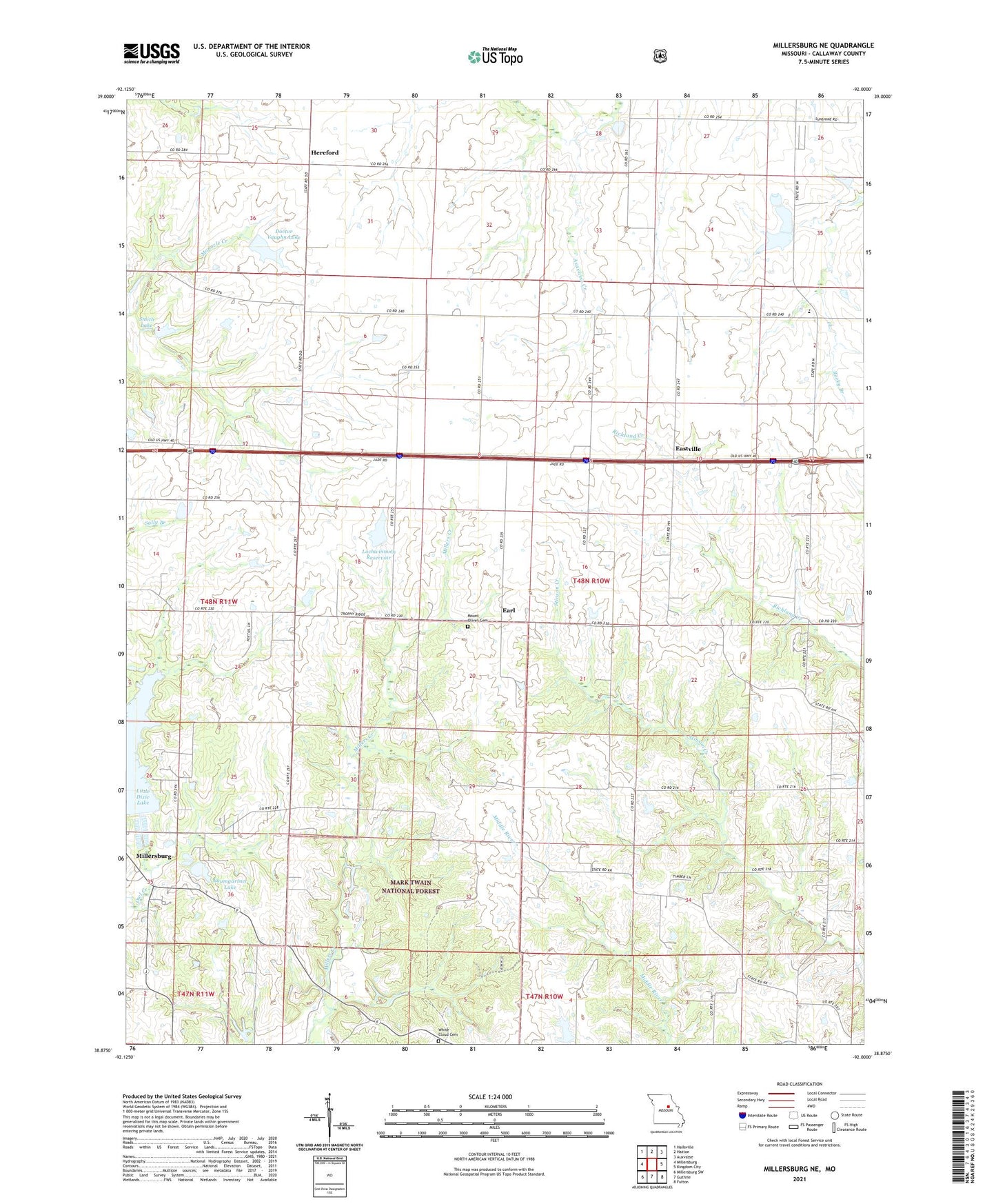
Millersburg NE Missouri US Topo Map
Couldn't load pickup availability
Also explore the Millersburg NE Forest Service Topo of this same quad for updated USFS data
2021 topographic map quadrangle Millersburg NE in the state of Missouri. Scale: 1:24000. Based on the newly updated USGS 7.5' US Topo map series, this map is in the following counties: Callaway. The map contains contour data, water features, and other items you are used to seeing on USGS maps, but also has updated roads and other features. This is the next generation of topographic maps. Printed on high-quality waterproof paper with UV fade-resistant inks.
Quads adjacent to this one:
West: Millersburg
Northwest: Hallsville
North: Hatton
Northeast: Auxvasse
East: Kingdom City
Southeast: Fulton
South: Guthrie
Southwest: Millersburg SW
This map covers the same area as the classic USGS quad with code o38092h1.
Contains the following named places: Baumgartner Dam, Baumgartner Lake, Castle Lake Dam, Crooked Creek Campground, Davis Lake Dam, Discwasher Incorporated Dam, Doctor Vaughn Lake, Earl, Eastville, Grand Prairie, Hatton-McCredie Elementary School, Headache Lake Dam, Hereford, Lehenbauer Lake Section 35 Dam, Little Dixie Dam, Little Dixie Lake, Little Dixie State Wildlife Management Area, Lochwinnoch Dam, Lochwinnoch Reservoir, McClellan School, Miller School, Millersburg, Mount Olivet Cemetery, New Richland Church, New Richland School, Prairie Chapel, Red Brush School, Rising Sun Church, Smith Dam, Smith Lake, Sunrise School, Township of Bourbon, Township of Cleveland, Triple Cove Reservoir, Vaughn Dam, Wallace School, White Cloud Cemetery, White Cloud Church