MyTopo
Mexico SE Missouri US Topo Map
Couldn't load pickup availability
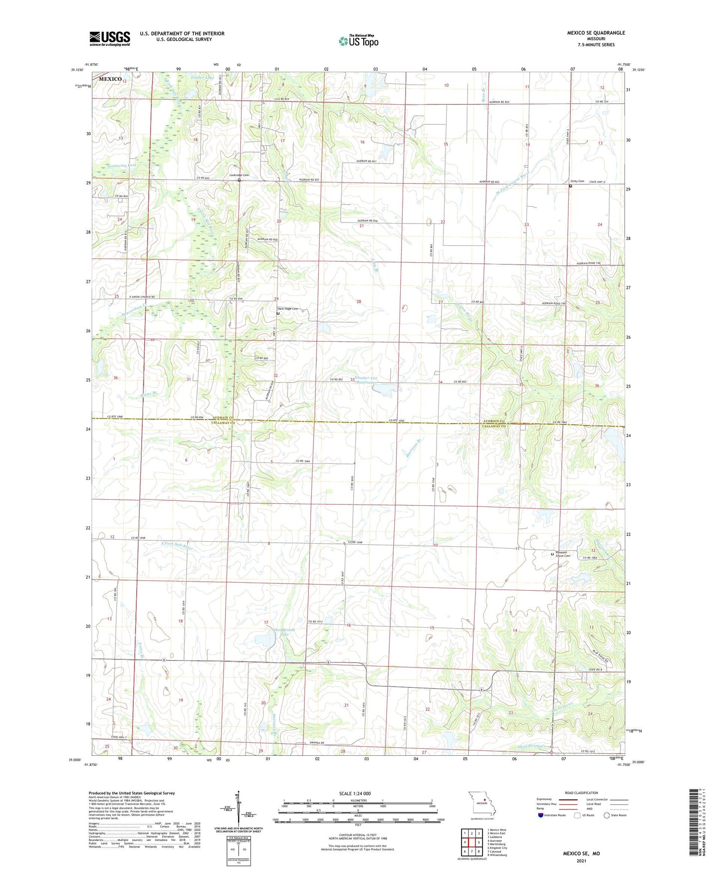
2021 topographic map quadrangle Mexico SE in the state of Missouri. Scale: 1:24000. Based on the newly updated USGS 7.5' US Topo map series, this map is in the following counties: Callaway, Audrain. The map contains contour data, water features, and other items you are used to seeing on USGS maps, but also has updated roads and other features. This is the next generation of topographic maps. Printed on high-quality waterproof paper with UV fade-resistant inks.
Quads adjacent to this one:
West: Auxvasse
Northwest: Mexico West
North: Mexico East
Northeast: Laddonia
East: Martinsburg
Southeast: Williamsburg
South: Calwood
Southwest: Kingdom City
This map covers the same area as the classic USGS quad with code o39091a7.
Contains the following named places: Beaverdam Creek, Boles School, Braun Lake Dam, Buckner Lake Dam, Don Woods Lake, Hickory Grove School, Jackson School, Lockridge Cemetery, New Hope Cemetery, Number 222 Reservoir, Pleasant Grove Cemetery, Rogers Lake Dam, Scattering Fork, Stauffer School, Sunrise School, Timber Lake, Township of Jackson, Union Church, Unity Cemetery, Watts Branch, Whalen Dam, White Oak Branch, Woods Dam North, Woods Dam South