MyTopo
Bethany Missouri US Topo Map
Couldn't load pickup availability
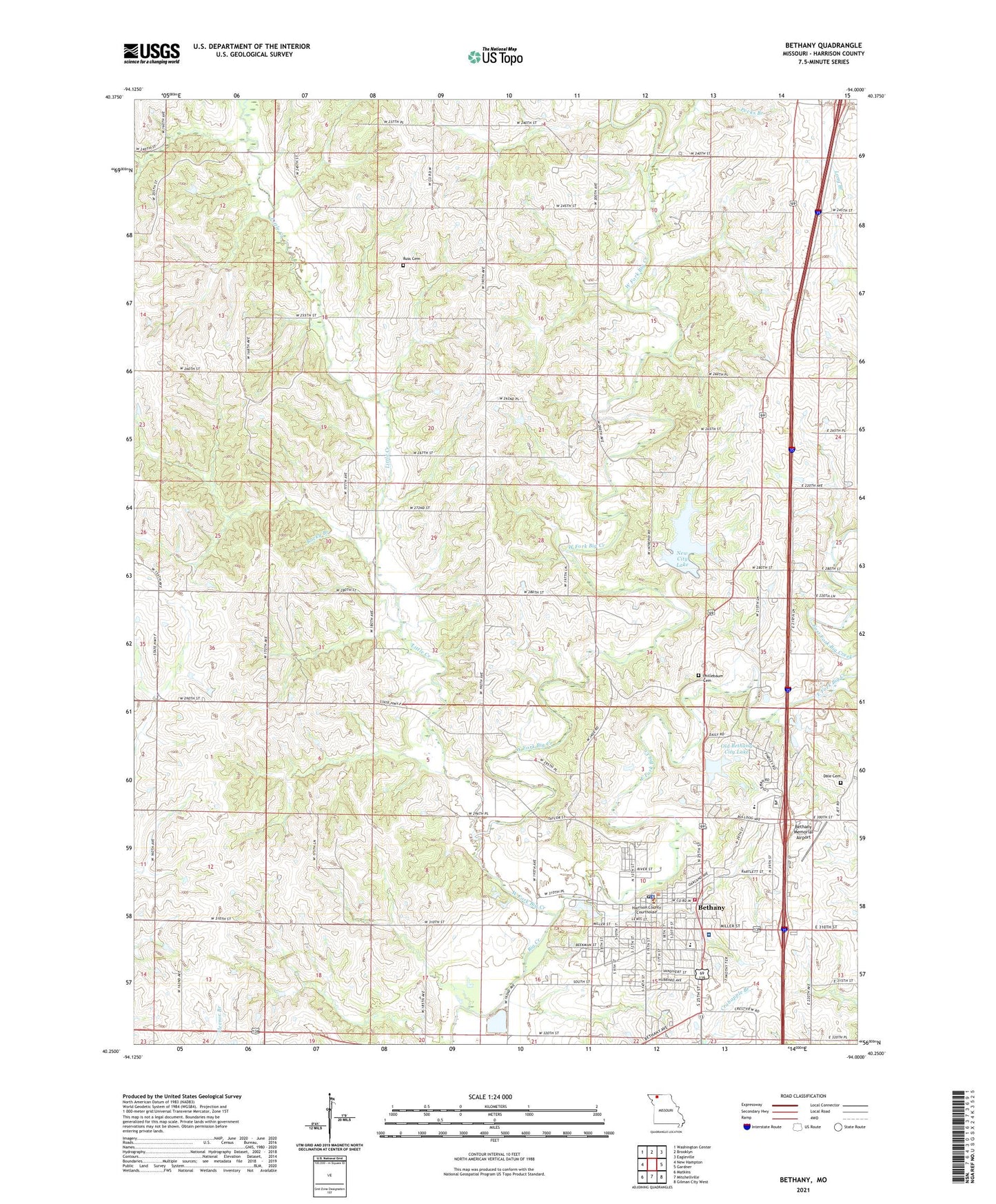
2021 topographic map quadrangle Bethany in the state of Missouri. Scale: 1:24000. Based on the newly updated USGS 7.5' US Topo map series, this map is in the following counties: Harrison. The map contains contour data, water features, and other items you are used to seeing on USGS maps, but also has updated roads and other features. This is the next generation of topographic maps. Printed on high-quality waterproof paper with UV fade-resistant inks.
Quads adjacent to this one:
West: New Hampton
Northwest: Washington Center
North: Brooklyn
Northeast: Eagleville
East: Gardner
Southeast: Gilman City West
South: Mitchellville
Southwest: Matkins
Contains the following named places: Belle School, Bethany, Bethany City Reservoir Dam, Bethany Fire Department, Bethany Memorial Airport, Bethany Post Office, Bowman, Buck Branch, City of Bethany, Dale Cemetery, East Fork Big Creek, Globe School, Grand Trace State Forest, Harrison County Community Hospital, Harrison County Farm, Harrison County Sheriff's Office, Hazel Valley Church, Little Creek, Lorrain School, Mahaska School, McCollum School, Morris Chapel, Mount Taber School, New City Lake, North Central Career Center, Oakland Church, Old Bethany City Lake, Pecks Branch, Phillebaum Cemetery, Rocky Branch, Russ Cemetery, Shady Grove Church, South Harrison Elementary School, South Harrison Junior Senior High School, South Pine School, Star School, Township of Bethany, Township of Jefferson, Union Chapel, West Fork Big Creek, White Fawn School, ZIP Code: 64424