MyTopo
New Hampton Missouri US Topo Map
Couldn't load pickup availability
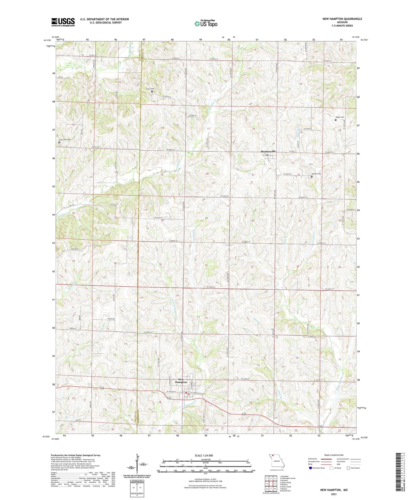
2021 topographic map quadrangle New Hampton in the state of Missouri. Scale: 1:24000. Based on the newly updated USGS 7.5' US Topo map series, this map is in the following counties: Harrison, Gentry. The map contains contour data, water features, and other items you are used to seeing on USGS maps, but also has updated roads and other features. This is the next generation of topographic maps. Printed on high-quality waterproof paper with UV fade-resistant inks.
Quads adjacent to this one:
West: Albany North
Northwest: Allendale
North: Washington Center
Northeast: Brooklyn
East: Bethany
Southeast: Mitchellville
South: Matkins
Southwest: Albany South
This map covers the same area as the classic USGS quad with code o40094c2.
Contains the following named places: Adam School, Ames Branch, Burton School, City of New Hampton, Glendenning School, Grace Cemetery, KAAN-AM (Bethany), KAAN-FM (Bethany), Kidwell Cemetery, Locust Grove School, Lone Star Cemetery, Magee Cemetery, Martinsville, Martinsville Post Office, Mount Zion Church, New Hampton, New Hampton Post Office, New Hampton Volunteer Fire Protection District, Pony Branch, Township of Dallas, Township of White Oak, Walnut Grove School, West Fork Sampson Creek, Willow Row Church, ZIP Code: 64471