
MyTopo
Bevier South Missouri US Topo Map
Couldn't load pickup availability
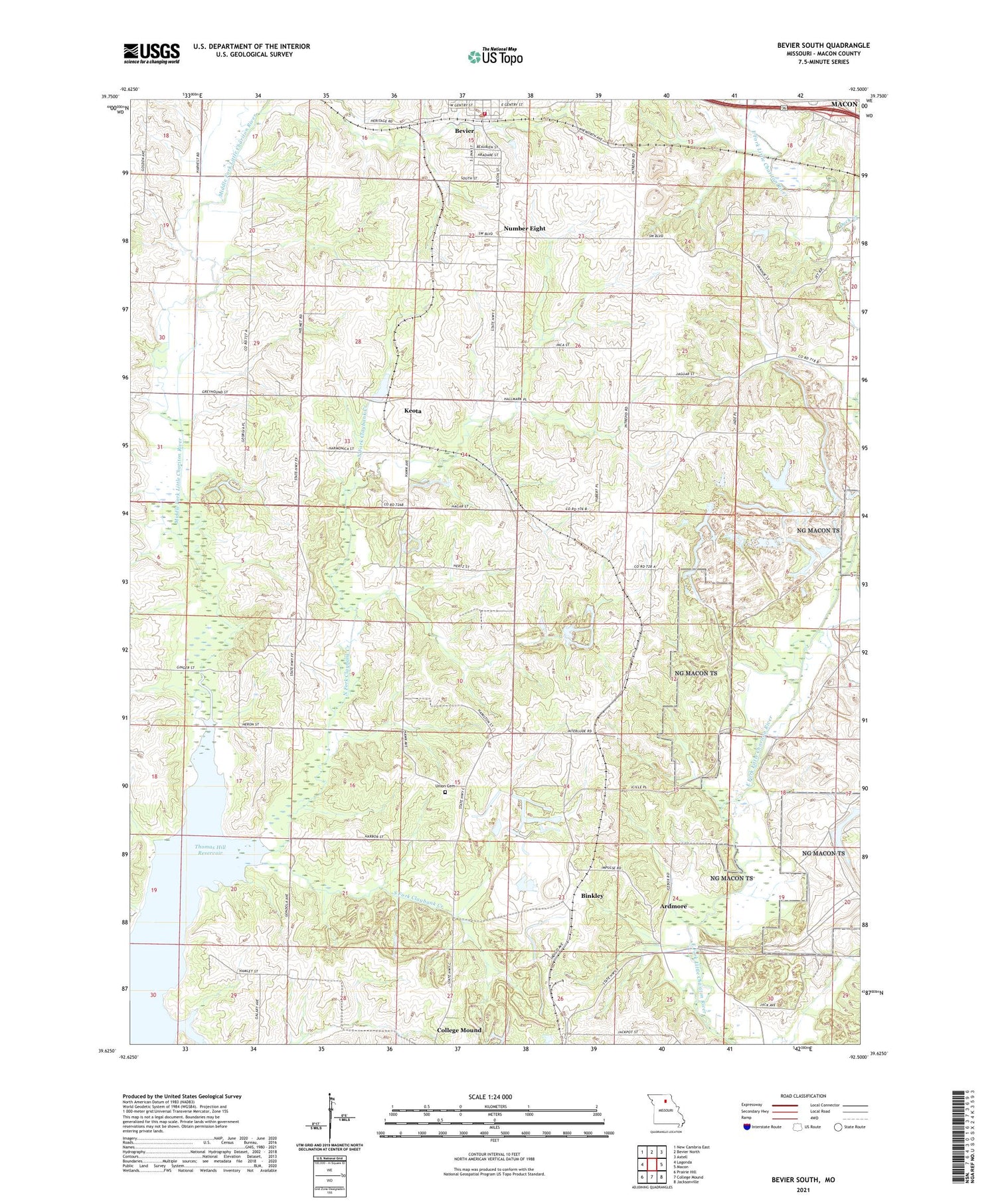
2021 topographic map quadrangle Bevier South in the state of Missouri. Scale: 1:24000. Based on the newly updated USGS 7.5' US Topo map series, this map is in the following counties: Macon. The map contains contour data, water features, and other items you are used to seeing on USGS maps, but also has updated roads and other features. This is the next generation of topographic maps. Printed on high-quality waterproof paper with UV fade-resistant inks.
Quads adjacent to this one:
West: Lagonda
Northwest: New Cambria East
North: Bevier North
Northeast: Axtell
East: Macon
Southeast: Jacksonville
South: College Mound
Southwest: Prairie Hill
Contains the following named places: Antioch Church, Ardmore, Ardmore School, Bevier, Bevier Fire Department, Bevier Lake, Bevier Post Office, Binkley, Brammer School, Burris School, Central Coal and Coke Corporation Lake Dam, Chariton, Claybank Creek, Dewey School, Duck Creek, Elk Fork School, Gipson School, Greenwood School, Keota, Keota Lake, Keota Lake Dam, Keota School, Leathers School, Miller School, Mount Olive Church, New Salem Church, North Fork Claybank Creek, Northwestern, Number Eight, South Fork Claybank Creek, Thurman School, Township of Bevier, Township of Chariton, Union Cemetery, Winkle School


