MyTopo
Lagonda Missouri US Topo Map
Couldn't load pickup availability
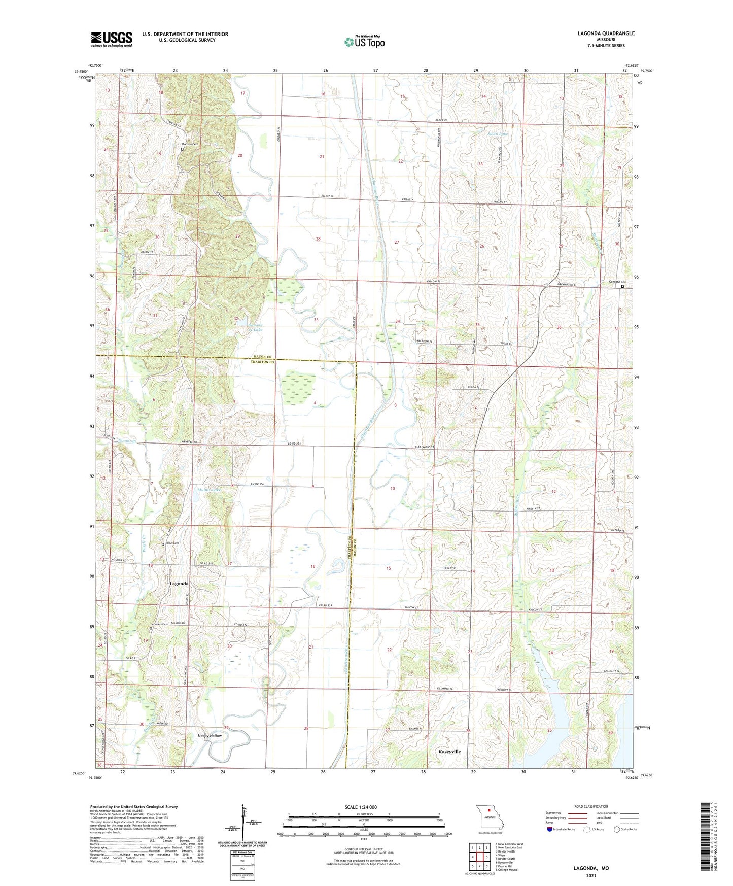
2021 topographic map quadrangle Lagonda in the state of Missouri. Scale: 1:24000. Based on the newly updated USGS 7.5' US Topo map series, this map is in the following counties: Macon, Chariton. The map contains contour data, water features, and other items you are used to seeing on USGS maps, but also has updated roads and other features. This is the next generation of topographic maps. Printed on high-quality waterproof paper with UV fade-resistant inks.
Quads adjacent to this one:
West: Wien
Northwest: New Cambria West
North: New Cambria East
Northeast: Bevier North
East: Bevier South
Southeast: College Mound
South: Prairie Hill
Southwest: Bynumville
This map covers the same area as the classic USGS quad with code o39092f6.
Contains the following named places: Barryville, Concord Cemetery, Concord Church, Davis School, Dodson Cemetery, Hammack, Hammock School, Johnson Cemetery, Johnson School, Kaseyville School, Lagonda, Marshall School, Minefree School, Morrow School, Mulnix Lake, Mulnix Lake Dam, Number 21 Lake, Oak Grove School, Rice Cemetery, Rose Hill School, Sleepy Hollow, Swan Lake, Swan Lake School, Temple Stephens Company Dam, Tenant Branch, Township of Callao, Township of Morrow, ZIP Code: 63534