MyTopo
Jacksonville Missouri US Topo Map
Couldn't load pickup availability
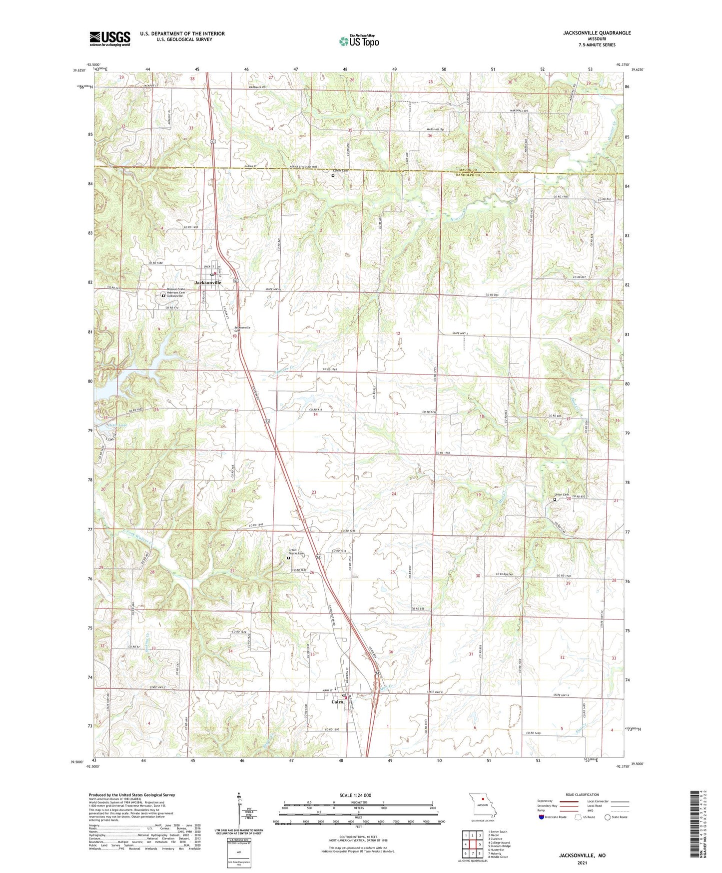
2021 topographic map quadrangle Jacksonville in the state of Missouri. Scale: 1:24000. Based on the newly updated USGS 7.5' US Topo map series, this map is in the following counties: Randolph, Macon. The map contains contour data, water features, and other items you are used to seeing on USGS maps, but also has updated roads and other features. This is the next generation of topographic maps. Printed on high-quality waterproof paper with UV fade-resistant inks.
Quads adjacent to this one:
West: College Mound
Northwest: Bevier South
North: Macon
Northeast: Clarence
East: Duncans Bridge
Southeast: Middle Grove
South: Moberly
Southwest: Huntsville
This map covers the same area as the classic USGS quad with code o39092e4.
Contains the following named places: Cairo, Cairo Post Office, Cairo Volunteer Fire Department, Colter Cemetery, Grand Prairie Cemetery, Hisle Lake, Hisle Lake Dam, Holiday Acres Lake - Upstream, Holiday Acres Lake Upstream Dam, Jacksonville, Jacksonville Cemetery, Jacksonville Post Office, Jacksonville Volunteer Fire Department, Liberty Church, McClainsville School, Missouri State Veterans Cemetery - Jacksonville, Mount Salem Church, Mount Vernon School, Northeast Elementary School, Northeast High School, Northeast Randolph Rural Fire Department Cairo, Pastrovich Lake, Pastrovich Lake Dam, Salem School, Snow, Snow Post Office, Township of Cairo, Township of Jackson, Union Cemetery, Village of Cairo, Village of Jacksonville, ZIP Codes: 65239, 65260