MyTopo
Brays Missouri US Topo Map
Couldn't load pickup availability
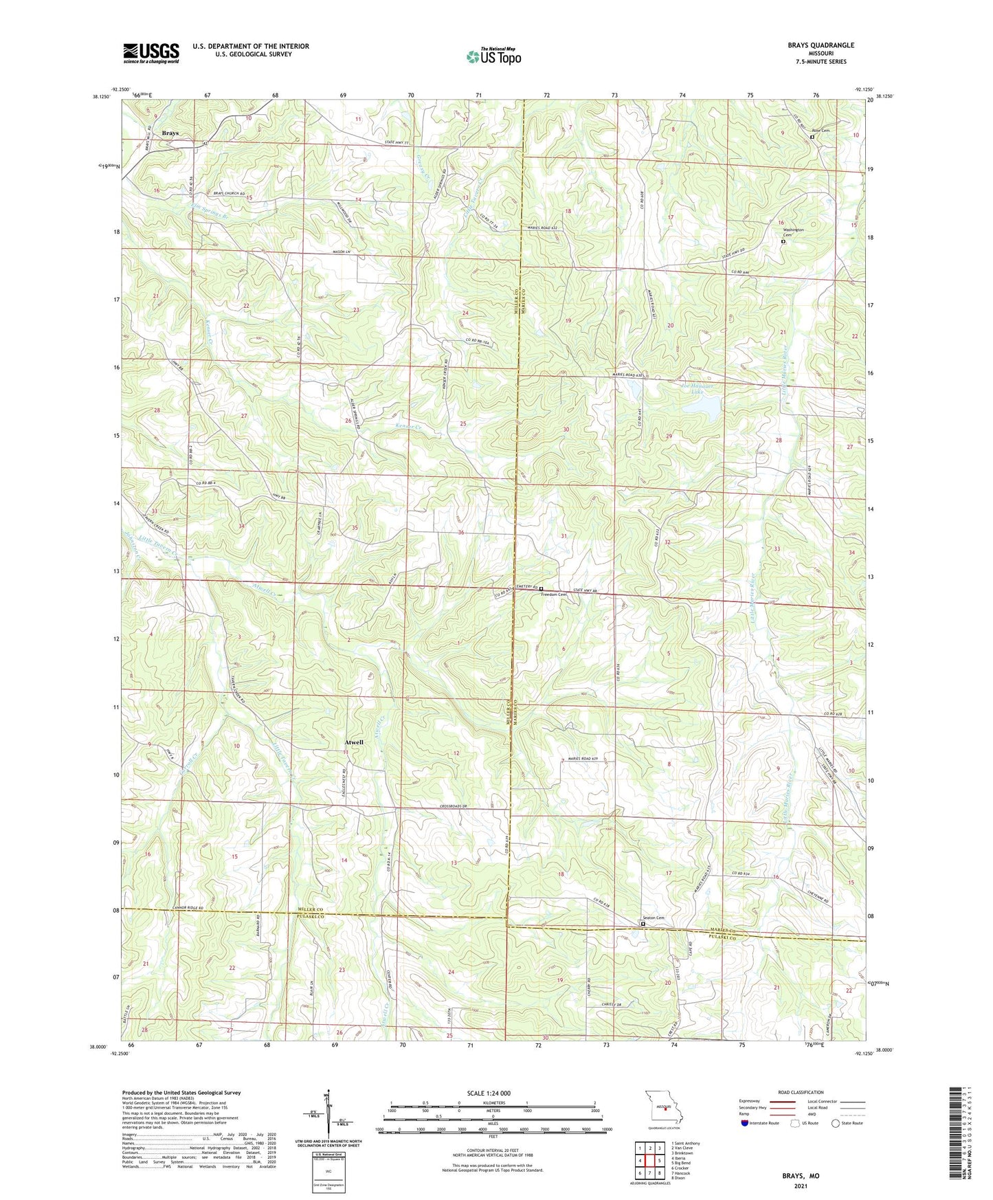
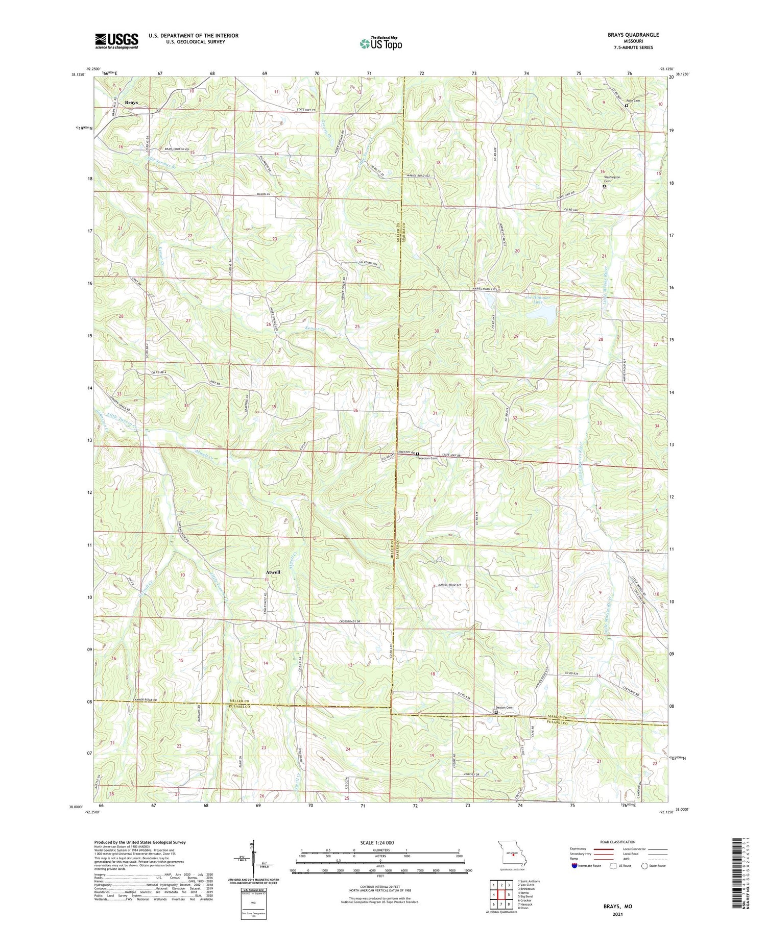
2021 topographic map quadrangle Brays in the state of Missouri. Scale: 1:24000. Based on the newly updated USGS 7.5' US Topo map series, this map is in the following counties: Miller, Maries, Pulaski. The map contains contour data, water features, and other items you are used to seeing on USGS maps, but also has updated roads and other features. This is the next generation of topographic maps. Printed on high-quality waterproof paper with UV fade-resistant inks.
Quads adjacent to this one:
West: Iberia
Northwest: Saint Anthony
North: Van Cleve
Northeast: Brinktown
East: Big Bend
Southeast: Dixon
South: Hancock
Southwest: Crocker
Contains the following named places: Alder Springs Church, Alder Springs School, Atwell, Atwell Creek, Atwell School, Berry School, Brays, Brays Mill, Brays School, Carroll Creek, Cleveland School, Cross School, Fox Crossing School, Freedom Church, Joe Hanauer Lake, Johnston Creek, Liberty School, Maries, Mount Gilead Church, Rinquelin Trail Community Lake State Wildlife Area, Rose Cemetery, Saber Lake Dam, Seaton Church, Share Lake Dam, Traderight, Union Church, Washington Baptist Church, Washington Cemetery, Washington School