MyTopo
Big Bend Missouri US Topo Map
Couldn't load pickup availability
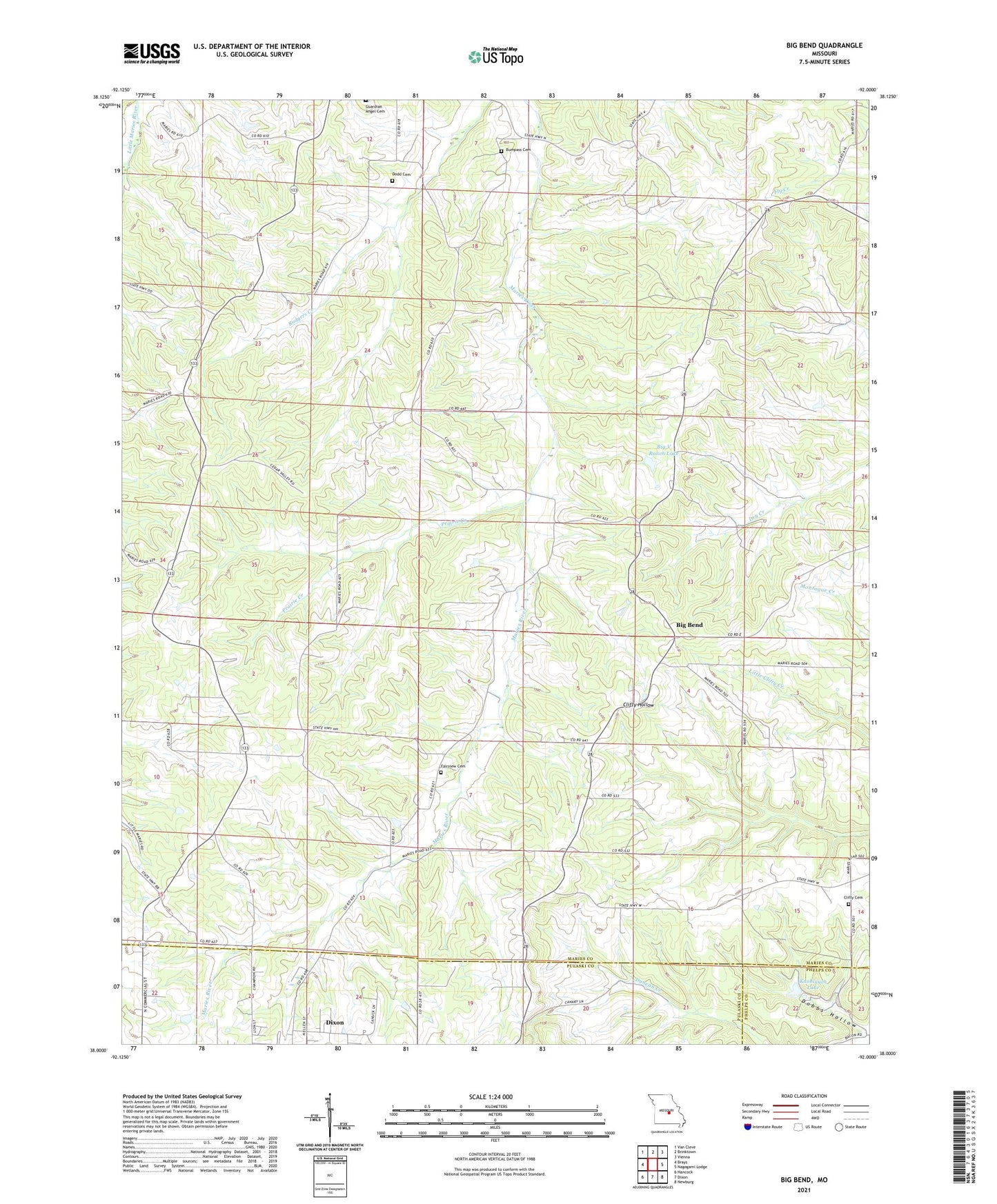
2021 topographic map quadrangle Big Bend in the state of Missouri. Scale: 1:24000. Based on the newly updated USGS 7.5' US Topo map series, this map is in the following counties: Maries, Pulaski, Phelps. The map contains contour data, water features, and other items you are used to seeing on USGS maps, but also has updated roads and other features. This is the next generation of topographic maps. Printed on high-quality waterproof paper with UV fade-resistant inks.
Quads adjacent to this one:
West: Brays
Northwest: Van Cleve
North: Brinktown
Northeast: Vienna
East: Nagogami Lodge
Southeast: Newburg
South: Dixon
Southwest: Hancock
This map covers the same area as the classic USGS quad with code o38092a1.
Contains the following named places: Big Bend, Big V Ranch Lake, Branson School, Bronson School, Bumpass Cemetery, Clifty School, Dobbs Hollow, Dodd Cemetery, Knoblauch Lake, Knoblauch Lake Dam, Prairie Creek, Salem School, Santee School, Shantytown, Sherrell Lake Dam, Township of Miller, Veasmann Lake Dam, Vogt Dam, Weldon, Weldon Post Office, West Fairview School, ZIP Code: 65459