MyTopo
Saint Anthony Missouri US Topo Map
Couldn't load pickup availability
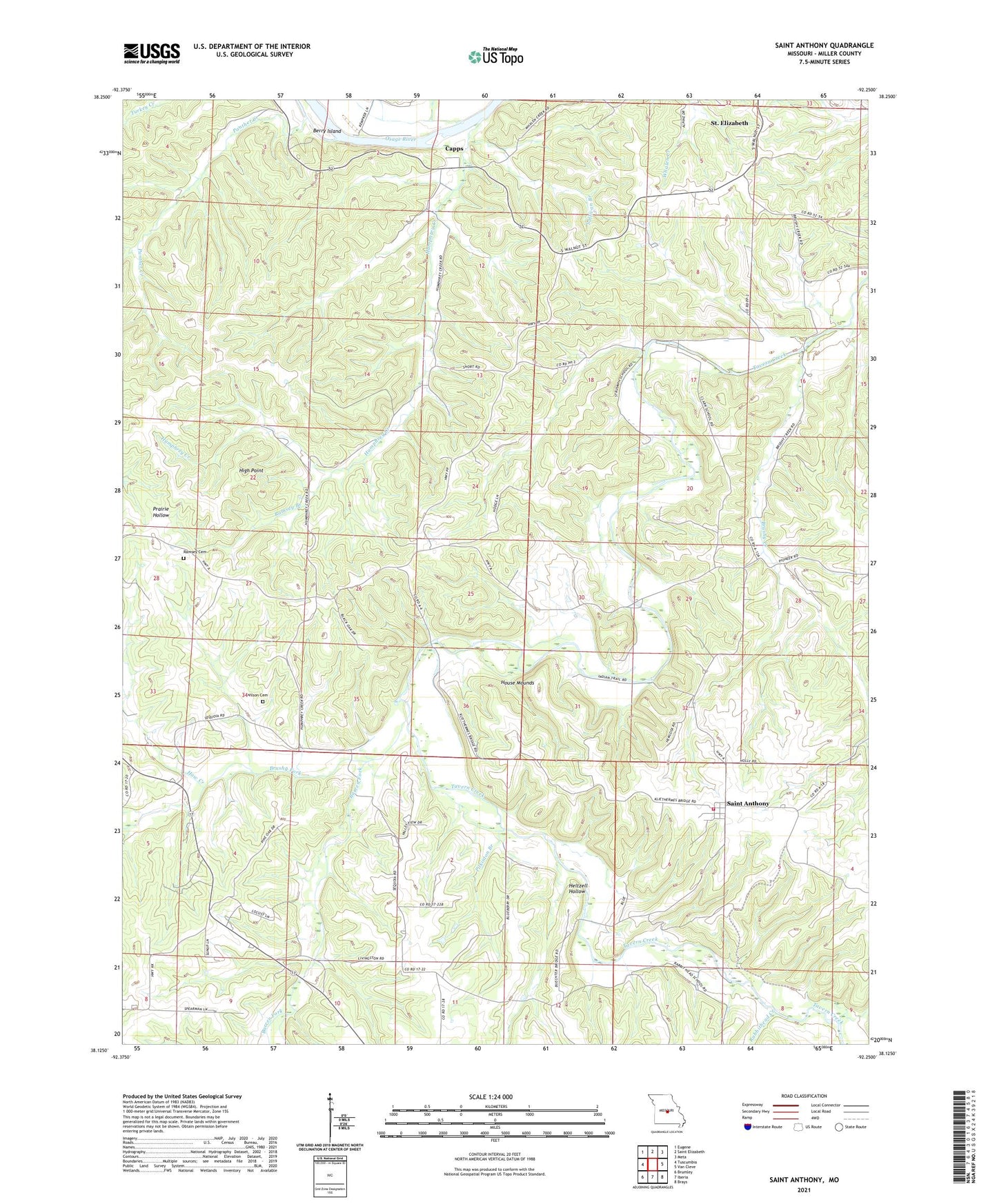
2021 topographic map quadrangle Saint Anthony in the state of Missouri. Scale: 1:24000. Based on the newly updated USGS 7.5' US Topo map series, this map is in the following counties: Miller. The map contains contour data, water features, and other items you are used to seeing on USGS maps, but also has updated roads and other features. This is the next generation of topographic maps. Printed on high-quality waterproof paper with UV fade-resistant inks.
Quads adjacent to this one:
West: Tuscumbia
Northwest: Eugene
North: Saint Elizabeth
Northeast: Meta
East: Van Cleve
Southeast: Brays
South: Iberia
Southwest: Brumley
This map covers the same area as the classic USGS quad with code o38092b3.
Contains the following named places: Bailey Branch, Barren Fork, Berry Island, Brushy Creek, Brushy Fork, Capps, Capps School, Elliott School, Fairview Church, Haw Creek, Heltzell Hollow, High Point, House Mounds, Humphrey Creek, Humphrey Creek Church, Iberia Rural Fire Protection District Station 2, Mountain View Church, Panther Creek, Pilkinton Branch, Rabbithead Creek, Ramsey Branch, Ramsey Cemetery, Saint Anthony, Strump School, Sullivan Branch, Township of Osage, Wilson Camp State Wildlife Area, Wilson Cemetery, Wilson School, ZIP Code: 65075