MyTopo
Brunswick East Missouri US Topo Map
Couldn't load pickup availability
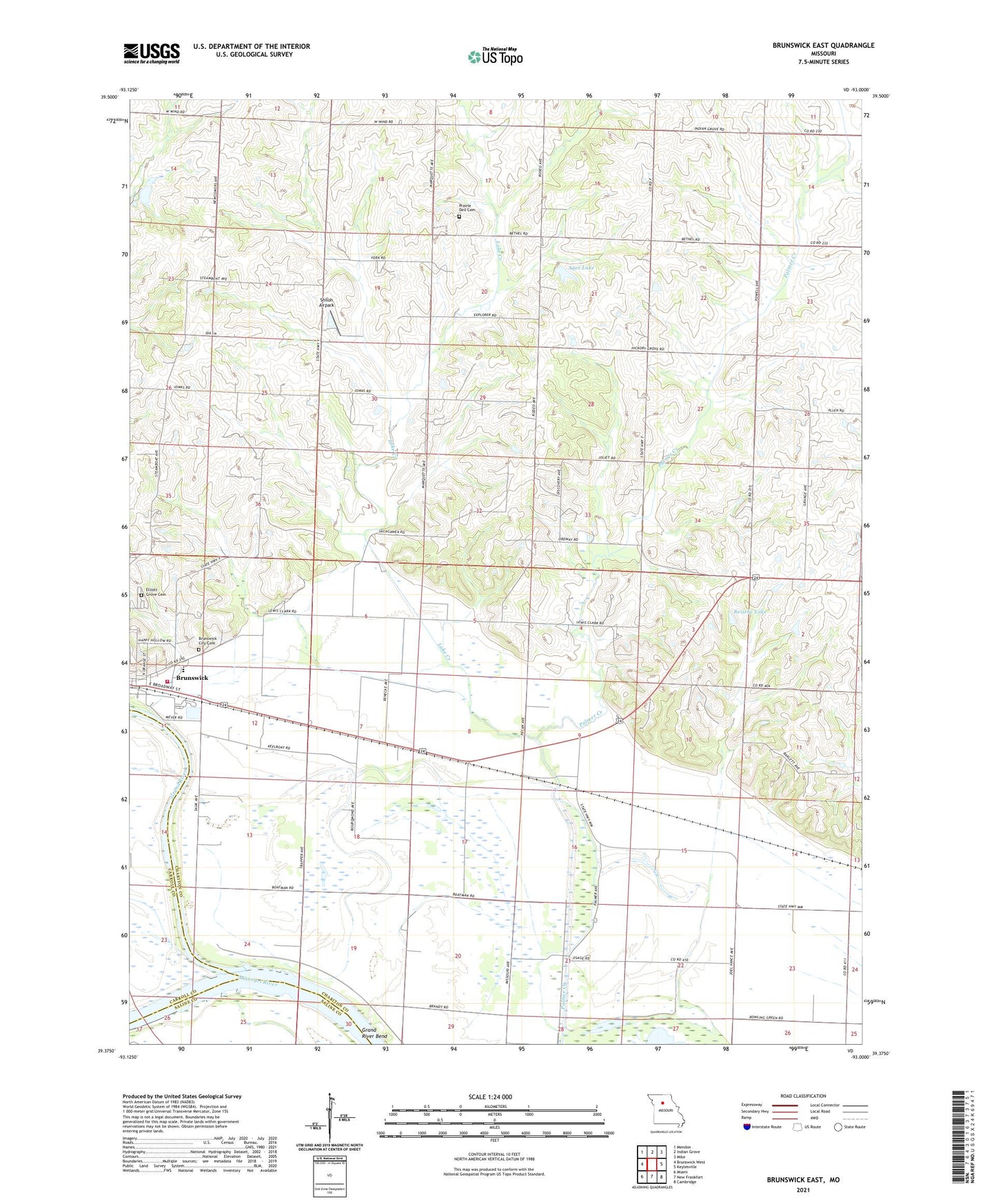
2021 topographic map quadrangle Brunswick East in the state of Missouri. Scale: 1:24000. Based on the newly updated USGS 7.5' US Topo map series, this map is in the following counties: Chariton, Carroll, Saline. The map contains contour data, water features, and other items you are used to seeing on USGS maps, but also has updated roads and other features. This is the next generation of topographic maps. Printed on high-quality waterproof paper with UV fade-resistant inks.
Quads adjacent to this one:
West: Brunswick West
Northwest: Mendon
North: Indian Grove
Northeast: Mike
East: Keytesville
Southeast: Cambridge
South: New Frankfort
Southwest: Miami
Contains the following named places: Agee Lake, Agee Lake Dam, Bethel Church, Bluff Point School, Brandt School, Brunswick City Cemetery, Brunswick Fire Department, Elliott Grove Cemetery, Foggin School, Grand Port, Grand River, Grand River City, Hazel Ridge School, Hickory Grove School, Jordan School, Lake Creek, Manson School, Missouri Village, Number 275 Dam, Prairie Chapel, Prairie Chapel School, Prairle Dell Cemetery, Reische Lake, Reische Lake Dam, Shiloh Airpark, Township of Brunswick, ZIP Code: 65236