MyTopo
Mendon Missouri US Topo Map
Couldn't load pickup availability
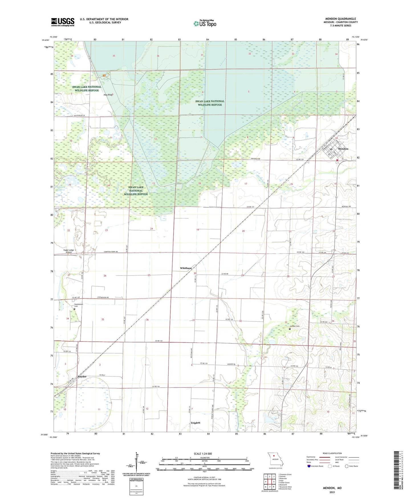
2021 topographic map quadrangle Mendon in the state of Missouri. Scale: 1:24000. Based on the newly updated USGS 7.5' US Topo map series, this map is in the following counties: Chariton. The map contains contour data, water features, and other items you are used to seeing on USGS maps, but also has updated roads and other features. This is the next generation of topographic maps. Printed on high-quality waterproof paper with UV fade-resistant inks.
Quads adjacent to this one:
West: Hale
Northwest: Fountain Grove
North: Sumner
Northeast: Rothville
East: Indian Grove
Southeast: Brunswick East
South: Brunswick West
Southwest: Bosworth
This map covers the same area as the classic USGS quad with code o39093e2.
Contains the following named places: City of Mendon, Collinswood, Eagle Lodge Airport, Elk Creek, Hampton Feed Lot, Hickory Branch, Hog Ridge, Hog Ridge School, Jackson Cemetery, Levee 2 - South Pool Dam, Levee 3-Silver Lake Dam, Levee 5-Swan Lake Dam, Mendon, Mendon Post Office, Mendon Public Fire Protection District, Refuge Headquarters, Silver Lake, Silver Lake Pool, Snyder, South Lake, South Pool, Stephenson Cemetery, Stephenson School, Swan Lake, Swan Lake National Wildlife Refuge, Swan Lake Pool, Township of Mendon, Township of Triplett, Whitham, ZIP Code: 65286