MyTopo
Cainsville Missouri US Topo Map
Couldn't load pickup availability
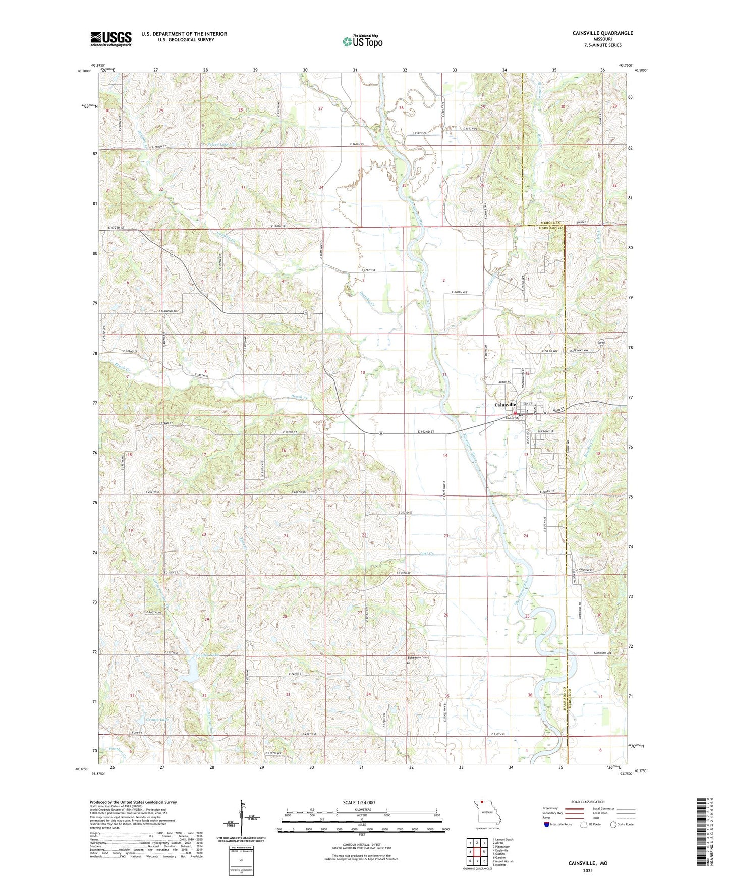
2021 topographic map quadrangle Cainsville in the state of Missouri. Scale: 1:24000. Based on the newly updated USGS 7.5' US Topo map series, this map is in the following counties: Harrison, Mercer. The map contains contour data, water features, and other items you are used to seeing on USGS maps, but also has updated roads and other features. This is the next generation of topographic maps. Printed on high-quality waterproof paper with UV fade-resistant inks.
Quads adjacent to this one:
West: Eagleville
Northwest: Lamoni South
North: Akron
Northeast: Pleasanton
East: Goshen
Southeast: Modena
South: Mount Moriah
Southwest: Gardner
Contains the following named places: Banner School, Bohemian Cemetery, Booth Lake, Brush Creek, Brushy Creek, Cainsville, Cainsville Elementary School, Cainsville Fire Protection District, Cainsville High School, Cainsville Post Office, City of Cainsville, Coal Creek, Conner Branch, Crause School, Donaby Creek, Donaby School, Fairview Church, Glaze Church, Glaze School, Grants Lake, Indian Creek, Keller School, Little Creek, Lost Creek, Lynn School, Mlika Lake Dam, Moore School, Panther Creek Watershed Dam D-1, Panther Creek Watershed Dam F-10, Pelzer Lake, Pelzer Lake Dam, Phoenix School, Reeder Lake, Snowball School, Township of Madison, Victor School, Whiteoak School, ZIP Code: 64632