MyTopo
Akron Missouri US Topo Map
Couldn't load pickup availability
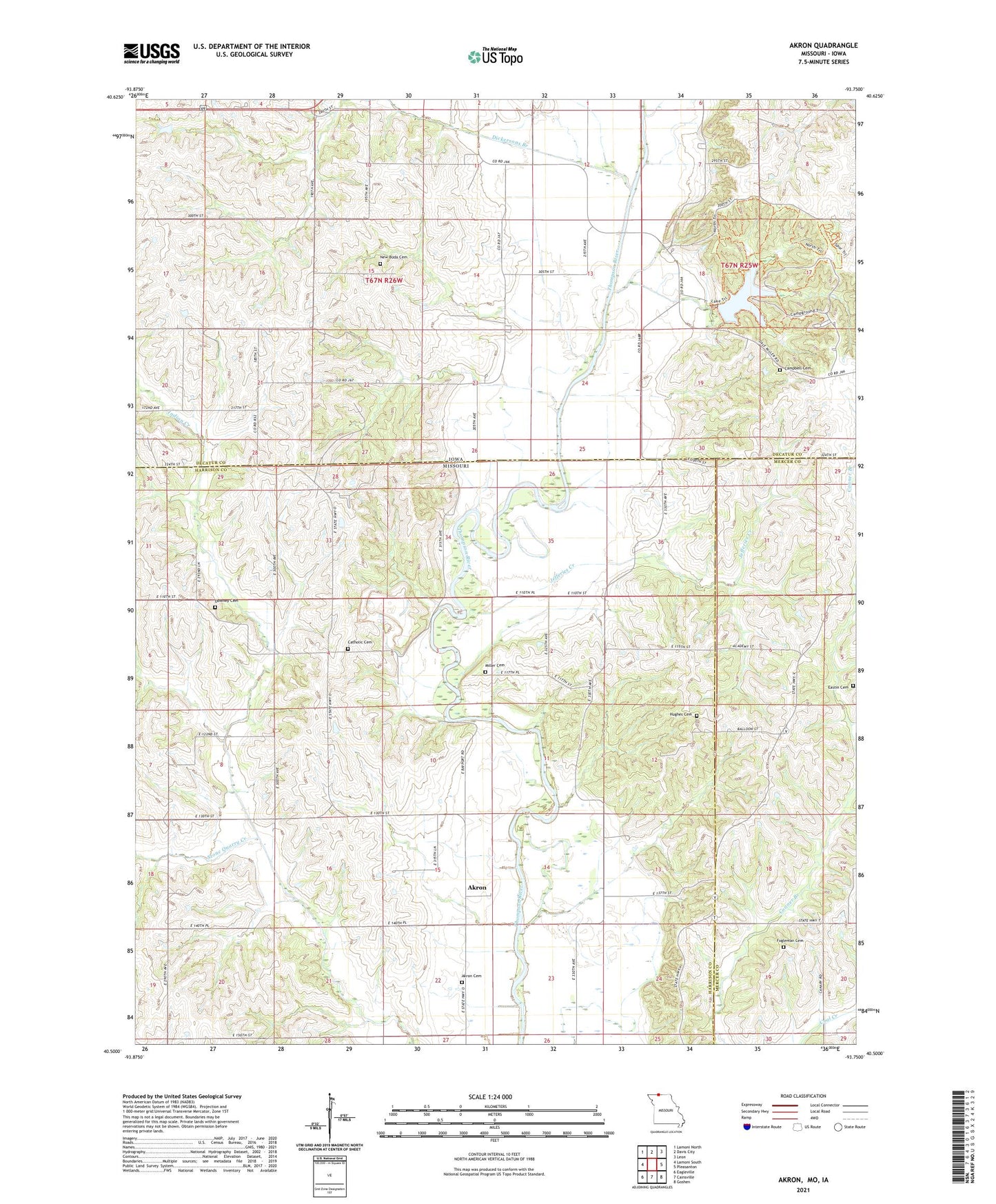
2021 topographic map quadrangle Akron in the states of Missouri, Iowa. Scale: 1:24000. Based on the newly updated USGS 7.5' US Topo map series, this map is in the following counties: Harrison, Decatur, Mercer. The map contains contour data, water features, and other items you are used to seeing on USGS maps, but also has updated roads and other features. This is the next generation of topographic maps. Printed on high-quality waterproof paper with UV fade-resistant inks.
Quads adjacent to this one:
West: Lamoni South
Northwest: Lamoni North
North: Davis City
Northeast: Leon
East: Pleasanton
Southeast: Goshen
South: Cainsville
Southwest: Eagleville
This map covers the same area as the classic USGS quad with code o40093e7.
Contains the following named places: Akron, Akron Cemetery, Akron Townhall, Burrows, Campbell Cemetery, Dickersons Branch, Downey Cemetery, Downey School, Eastin Cemetery, Fogleman Cemetery, Hagan School, Hughes Cemetery, Hutchinson School, Jefferies Creek, Miller Cemetery, Mount Pleasant School, New Buda, New Buda Cemetery, New Buda Post Office, Nine Eagles Lake, Nine Eagles State Park, Saint Marys Cemetery, Stone Quarry Creek, Surprise School, Toad Valley School, Township of Clay, Township of New Buda, ZIP Codes: 50065, 64426