MyTopo
Goshen Missouri US Topo Map
Couldn't load pickup availability
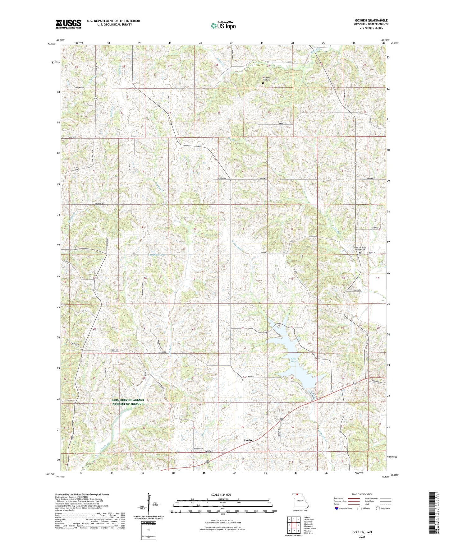
2021 topographic map quadrangle Goshen in the state of Missouri. Scale: 1:24000. Based on the newly updated USGS 7.5' US Topo map series, this map is in the following counties: Mercer. The map contains contour data, water features, and other items you are used to seeing on USGS maps, but also has updated roads and other features. This is the next generation of topographic maps. Printed on high-quality waterproof paper with UV fade-resistant inks.
Quads adjacent to this one:
West: Cainsville
Northwest: Akron
North: Pleasanton
Northeast: Lineville
East: Princeton
Southeast: Mill Grove
South: Modena
Southwest: Mount Moriah
This map covers the same area as the classic USGS quad with code o40093d6.
Contains the following named places: Cain School, Campbell Lake, Campbell Lake Dam, Goshen, Goshen Cemetery, Goshen Church, Hamblin School, Hanes Church, Lake Paho, Lake Paho Dam, Lake Paho State Wildlife Area, Liberty Church, Moss School, Oakland School, Pleasant Hill Cemetery, Pleasant Hill School, Pleasant Ridge Church, Pleasant Ridge Church Cemetery, Pleasant Ridge School, Red Rock School, Rockhold School, Saint Paul Church, Scott Hill School, Township of Harrison, Union School, West White School