MyTopo
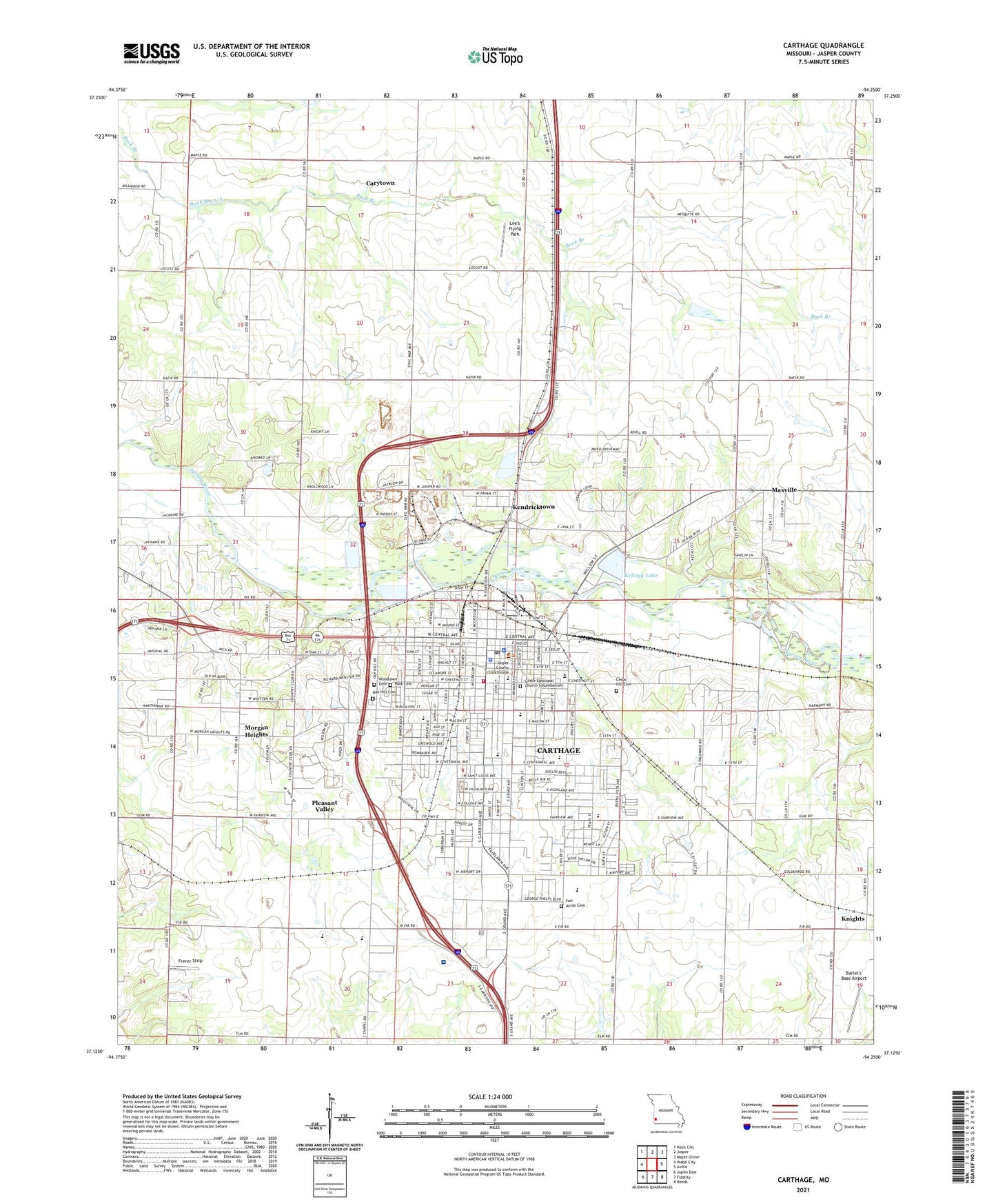
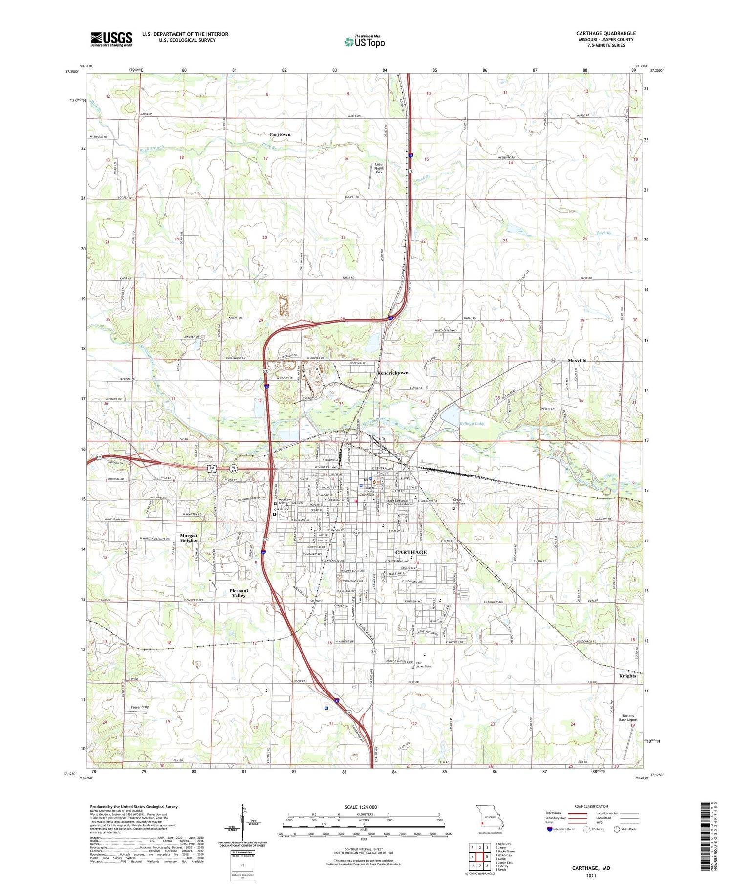
Carthage Missouri US Topo Map
Couldn't load pickup availability
2021 topographic map quadrangle Carthage in the state of Missouri. Scale: 1:24000. Based on the newly updated USGS 7.5' US Topo map series, this map is in the following counties: Jasper. The map contains contour data, water features, and other items you are used to seeing on USGS maps, but also has updated roads and other features. This is the next generation of topographic maps. Printed on high-quality waterproof paper with UV fade-resistant inks.
Quads adjacent to this one:
West: Webb City
Northwest: Neck City
North: Jasper
Northeast: Maple Grove
East: Avilla
Southeast: Reeds
South: Fidelity
Southwest: Joplin East
Contains the following named places: Barlet's Base Airport, Bethel Church, Camp Putnam, Carthage, Carthage Fire Department, Carthage High School, Carthage Junior High School, Carthage Middle School, Carthage Police Department, Carthage Post Office, Carthage Technical Center, Cedar Hill Cemetery, Centennial School, City of Carthage, Columbian Elementary School, Edwin, Eugene Field School, Fairview Church, Fairview Elementary School, Frerer Strip, Green Cove School, Green Grove School, Hawthorne School, High Hill School, Jasper County, Jasper County Sheriff's Office, KDMO-AM (Carthage), Kellogg Lake, Kellogg Lake Dam, Kellogg Lake Park, Kendricktown, Knells Park, Knights, KRGK-FM (Carthage), La Grange School, Lee's Flying Park, Lone Star School, Marion School, Mark Twain Elementary School, Maxville, Mercy Hospital Carthage, Monitor School, Morgan Heights, Myers Park Memorial Municipal Airport, Oak Hill Cemetery, Our Lady of the Ozarks College, Park Cemetery, Pleasant Grove School, Pleasant Valley, Prairie Dale School, Prairie View School, Radium School, Saint Anns School, Shiloh School, Steadley Elementary School, Township of Marion, ZIP Code: 64836