MyTopo
Reeds Missouri US Topo Map
Couldn't load pickup availability
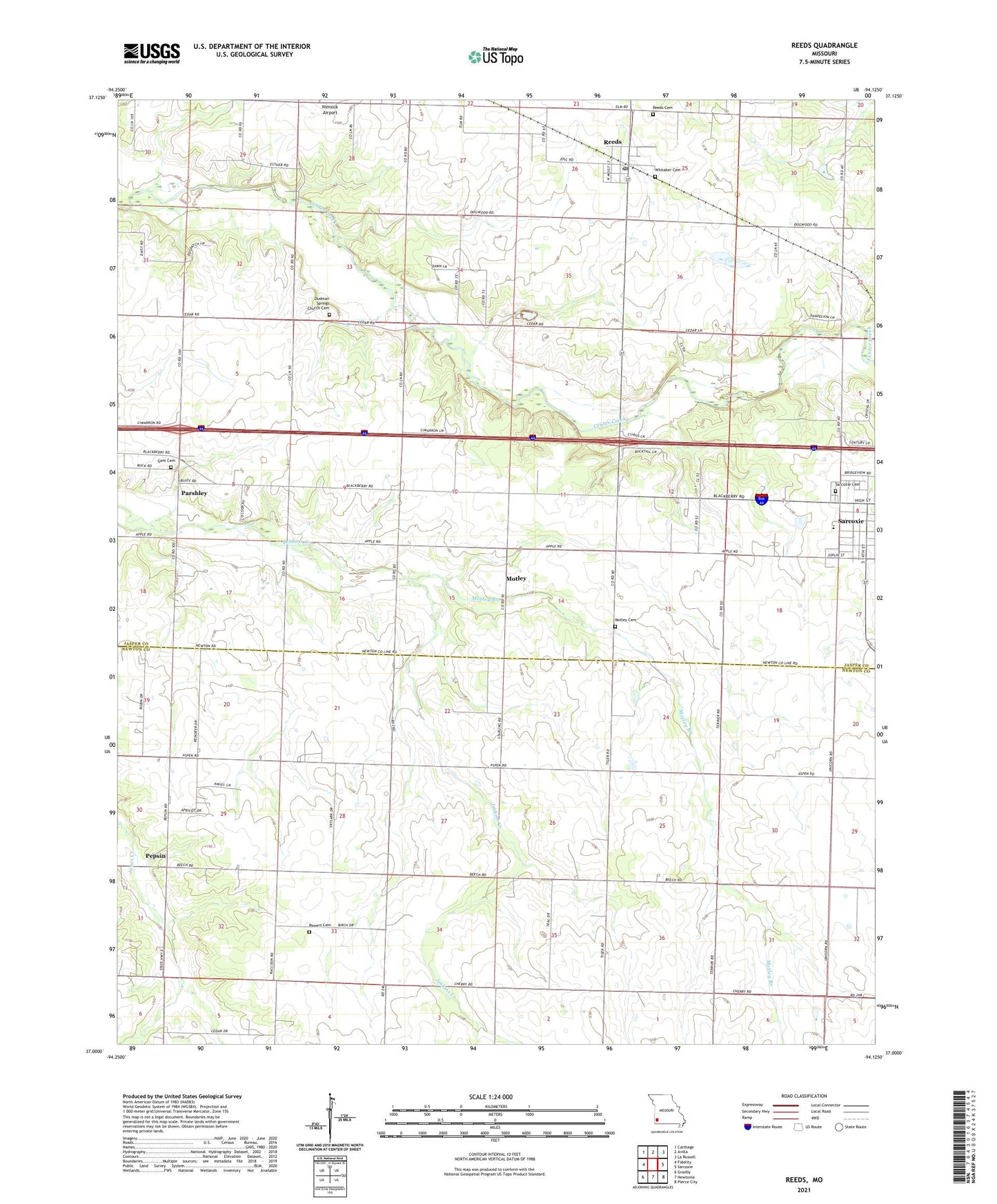
2021 topographic map quadrangle Reeds in the state of Missouri. Scale: 1:24000. Based on the newly updated USGS 7.5' US Topo map series, this map is in the following counties: Jasper, Newton. The map contains contour data, water features, and other items you are used to seeing on USGS maps, but also has updated roads and other features. This is the next generation of topographic maps. Printed on high-quality waterproof paper with UV fade-resistant inks.
Quads adjacent to this one:
West: Fidelity
Northwest: Carthage
North: Avilla
Northeast: La Russell
East: Sarcoxie
Southeast: Pierce City
South: Newtonia
Southwest: Granby
This map covers the same area as the classic USGS quad with code o37094a2.
Contains the following named places: Banner School, City of Sarcoxie, Dudman Springs Church, Fair Banks, Fairview School, Freedom Community Center, Gem Cemetery, Gem School, Jasper School, Motley, Motley Branch, Motley Cemetery, New Fairview Church, Parshley, Pepsin, Powers Cemetery, Prairie View School, Redwood Church, Redwood School, Reeds, Reeds Cemetery, Reeds Post Office, Saint Agnes Church, Sarcoxie Cemetery, Sarcoxie High School, Town of Reeds, Township of Union, Union School, Wesley Chapel