MyTopo
Centralia NE Missouri US Topo Map
Couldn't load pickup availability
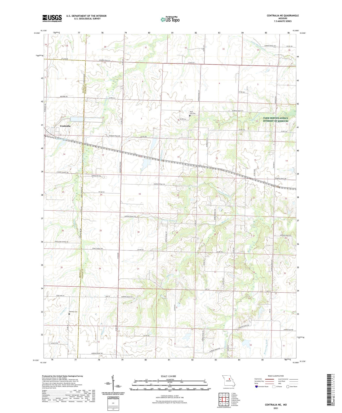
2021 topographic map quadrangle Centralia NE in the state of Missouri. Scale: 1:24000. Based on the newly updated USGS 7.5' US Topo map series, this map is in the following counties: Audrain, Boone. The map contains contour data, water features, and other items you are used to seeing on USGS maps, but also has updated roads and other features. This is the next generation of topographic maps. Printed on high-quality waterproof paper with UV fade-resistant inks.
Quads adjacent to this one:
West: Centralia
Northwest: Tulip
North: Rowena
Northeast: Molino
East: Mexico West
Southeast: Auxvasse
South: Hatton
Southwest: Hallsville
Contains the following named places: Bay Lake Dam, Daniel School, Gallaway Lake Dam, Gant, Gant School, German Cemetery, Harrison School, High Hill School, Highland School, Kon-Tiki Reservoir, Liberty Church, Little Dixie Fire Protection District Station 3, Mayes Creek, New Hope Church, Payne School, Pleasant Green School, Possum Walk Creek, Salisbury Lake Dam, Salt River Church, Schnarre-Ridder Lake Dam, Shellabarger Dam North, Shellabarger Dam South, Shellabarger Lake Dam, Skull Lick Cemetery, Skull Lick School, Township of Wilson, Wabash Lake, Wabash Lake Dam