MyTopo
Molino Missouri US Topo Map
Couldn't load pickup availability
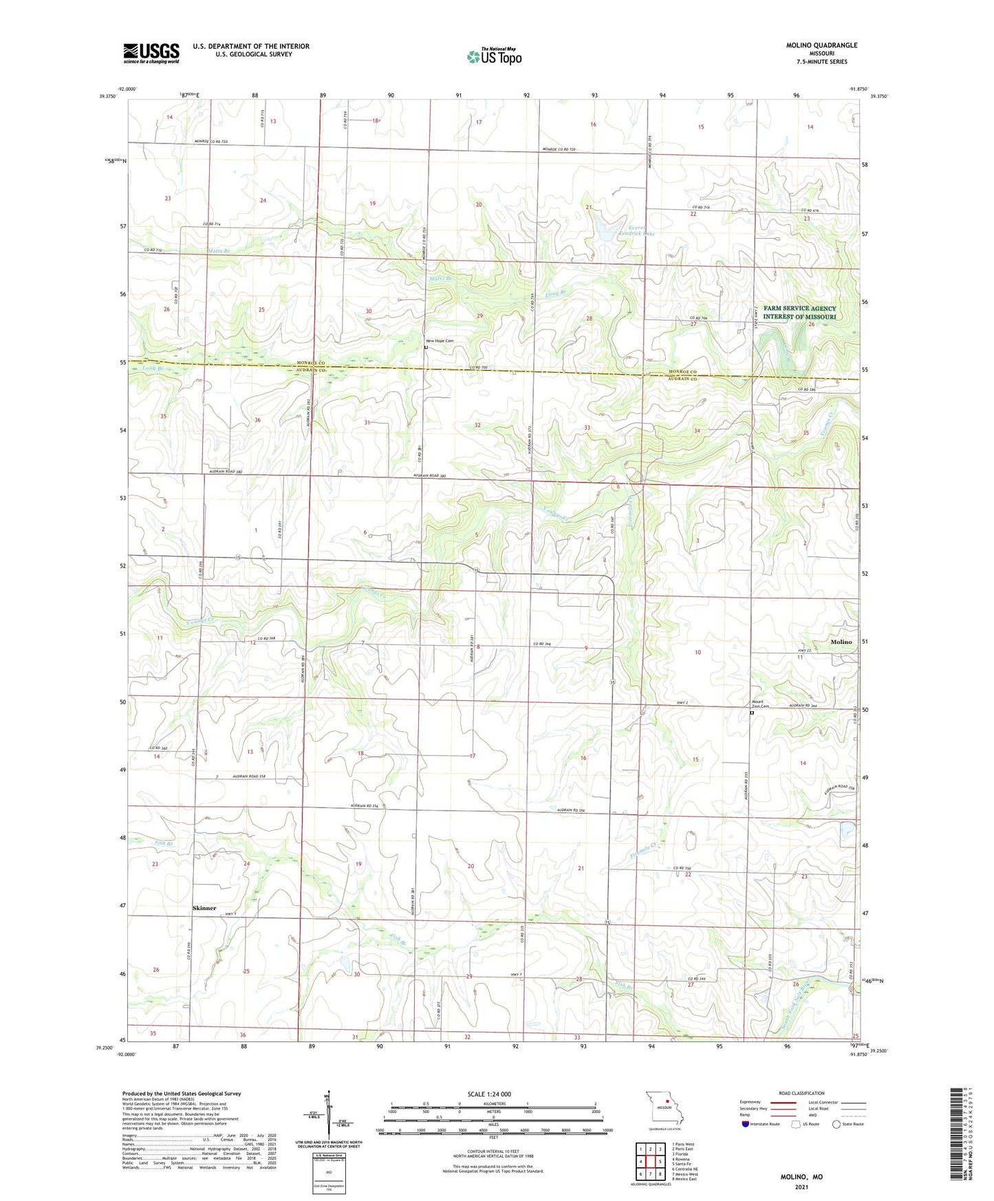
2021 topographic map quadrangle Molino in the state of Missouri. Scale: 1:24000. Based on the newly updated USGS 7.5' US Topo map series, this map is in the following counties: Audrain, Monroe. The map contains contour data, water features, and other items you are used to seeing on USGS maps, but also has updated roads and other features. This is the next generation of topographic maps. Printed on high-quality waterproof paper with UV fade-resistant inks.
Quads adjacent to this one:
West: Rowena
Northwest: Paris West
North: Paris East
Northeast: Florida
East: Santa Fe
Southeast: Mexico East
South: Mexico West
Southwest: Centralia NE
This map covers the same area as the classic USGS quad with code o39091c8.
Contains the following named places: Boyes Lake Dam, Bryan School, Carter School, Ellis School, Everet Kendrick Dam, Everet Kendrick Lake, Fivemile Creek, Gatewood School, Hi-Way R-3 School, Hollensville, Hollensville Post Office, Long Branch School, Matts Branch, Midway Church, Molino, Molino Census Designated Place, Mount Zion Cemetery, New Hope Cemetery, Number 610 Dam, Olivet Church, Sharp School, Skinner, Sneed School, Sweitzer Lake Dam, Youngs Creek, ZIP Code: 65285