MyTopo
Rowena Missouri US Topo Map
Couldn't load pickup availability
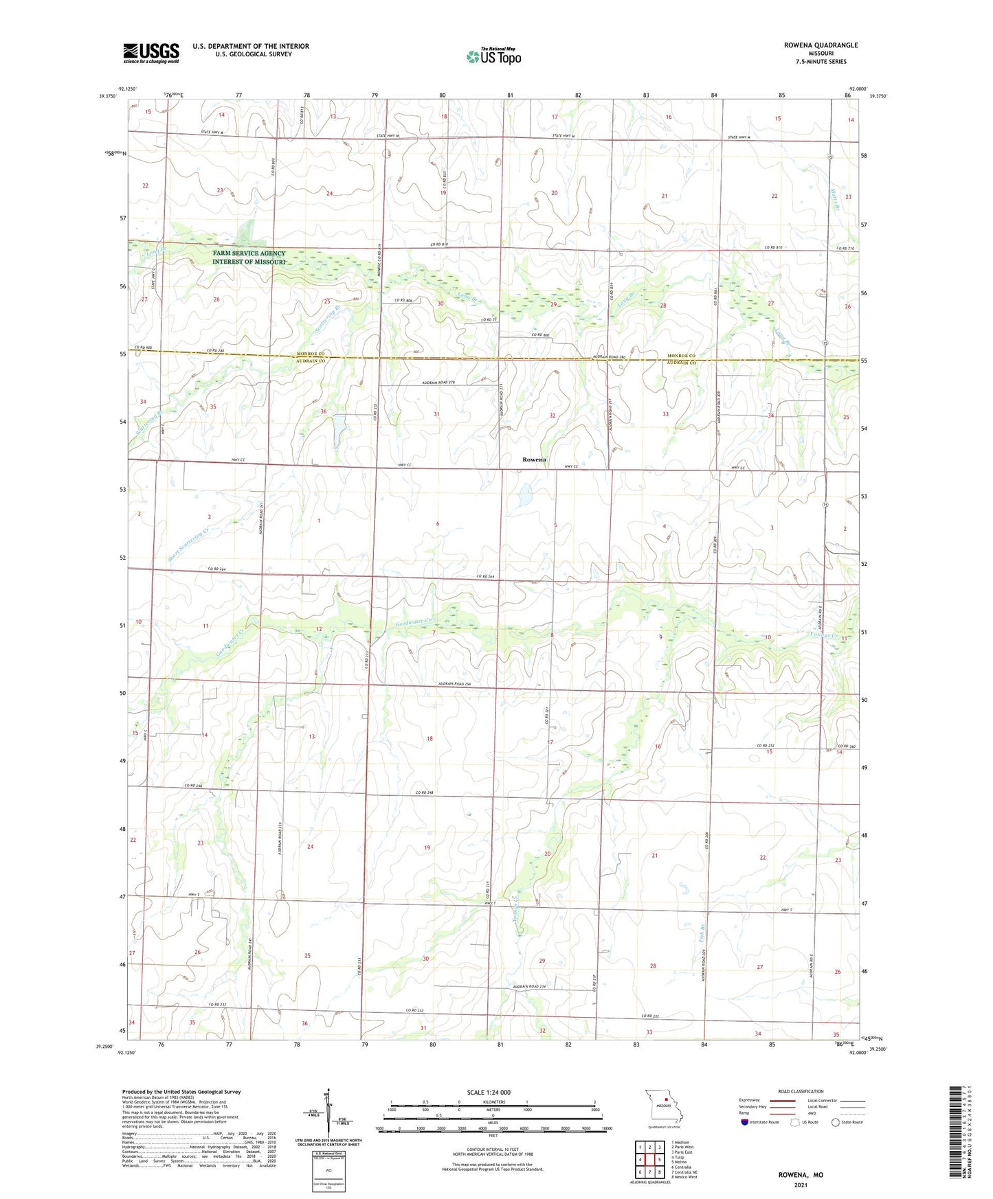
2021 topographic map quadrangle Rowena in the state of Missouri. Scale: 1:24000. Based on the newly updated USGS 7.5' US Topo map series, this map is in the following counties: Audrain, Monroe. The map contains contour data, water features, and other items you are used to seeing on USGS maps, but also has updated roads and other features. This is the next generation of topographic maps. Printed on high-quality waterproof paper with UV fade-resistant inks.
Quads adjacent to this one:
West: Tulip
Northwest: Madison
North: Paris West
Northeast: Paris East
East: Molino
Southeast: Mexico West
South: Centralia NE
Southwest: Centralia
This map covers the same area as the classic USGS quad with code o39092c1.
Contains the following named places: Antioch Church, Bethlehem Church, Central School, Cook Lake Dam, Donaldson Lake Dam, Excelsior School, Fuller School, Goodwater Creek, Goodwater School, Henry Lake Dam, Naylor School, Rowena, Scattering Branch, Short Scattering Creek, Sprock Farms Incorporated Lake Dam, Starr School, Strother School, Sudbrock Lake Dam