MyTopo
Chapel Hill Missouri US Topo Map
Couldn't load pickup availability
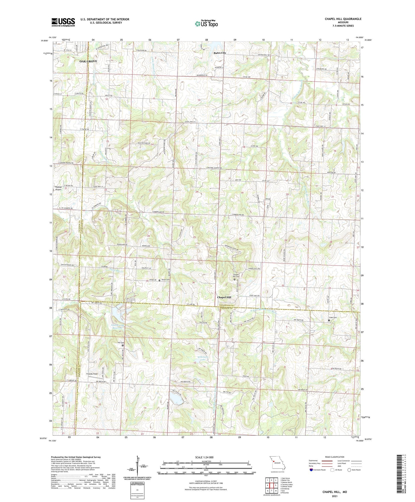
2021 topographic map quadrangle Chapel Hill in the state of Missouri. Scale: 1:24000. Based on the newly updated USGS 7.5' US Topo map series, this map is in the following counties: Lafayette, Johnson, Jackson. The map contains contour data, water features, and other items you are used to seeing on USGS maps, but also has updated roads and other features. This is the next generation of topographic maps. Printed on high-quality waterproof paper with UV fade-resistant inks.
Quads adjacent to this one:
West: Tarsney Lakes
Northwest: Oak Grove
North: Bates City
Northeast: Odessa North
East: Odessa South
Southeast: Pittsville
South: Elm
Southwest: Strasburg
This map covers the same area as the classic USGS quad with code o38094h1.
Contains the following named places: Brown Lake Dam, Chapel Hill, Cobb Cemetery, Concord Church, Country Store House Lake Dam, Dade School, Doty School, East Branch South Fork Blackwater River Watershed Structure A-5 Dam, Ferguson School, Friends Field, Hicks City, Hill Cemetery, KLTY-FM (Liberty), Lake Paradise Dam, Number 198 Reservoir, Oak Grove Primary School, Orr School, Pleasant Grove School, Rice Lake Dam, Saylor School, Shore Cemetery, Sionita School, Swope - Morris Lake Dam, Township of Sni-A-Bar, Webb School, Wilkinson Lake, Woodland School, ZIP Code: 64011