MyTopo
Cowgill Missouri US Topo Map
Couldn't load pickup availability
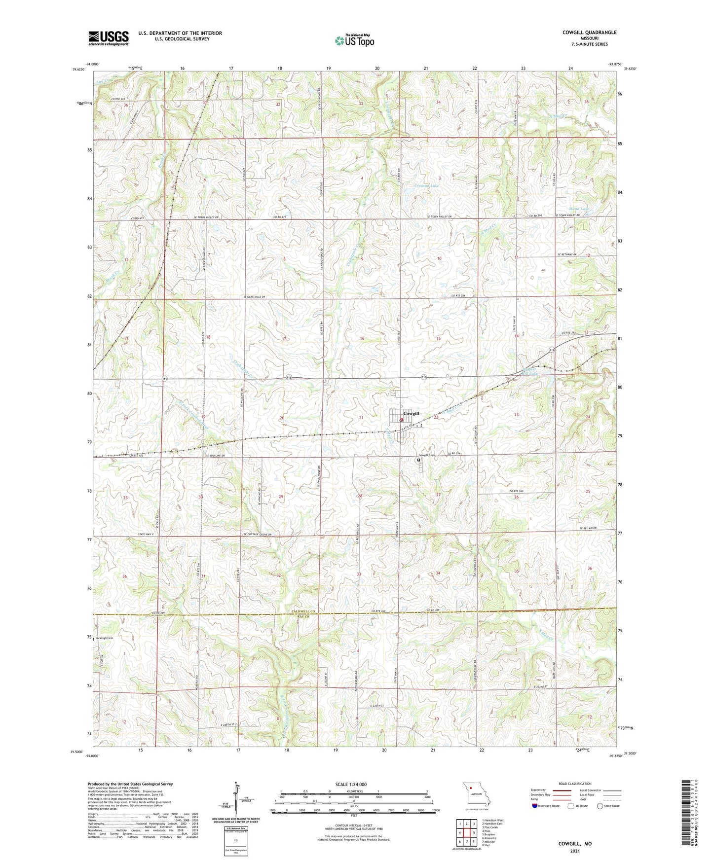
2021 topographic map quadrangle Cowgill in the state of Missouri. Scale: 1:24000. Based on the newly updated USGS 7.5' US Topo map series, this map is in the following counties: Caldwell, Ray. The map contains contour data, water features, and other items you are used to seeing on USGS maps, but also has updated roads and other features. This is the next generation of topographic maps. Printed on high-quality waterproof paper with UV fade-resistant inks.
Quads adjacent to this one:
West: Polo
Northwest: Hamilton West
North: Hamilton East
Northeast: Flat Creek
East: Braymer
Southeast: Stet
South: Millville
Southwest: Knoxville
Contains the following named places: Bethany School, Bonanza State Wildlife Area, Bunker Hill Lake, Bunker Hill Lake Dam, City of Cowgill, Cottage Grove School, Cowgill, Cowgill Cemetery, Cowgill Elementary School, Cowgill Town and Country Fire Department, Creason Lake, Creason Lake Dam, Eureka School, Excelsior School, Frog Pond School, Greenwood School, Little Union School, Mann Lake, Mann Lake Dam, Township of Lincoln, ZIP Code: 64637