MyTopo
Flat Creek Missouri US Topo Map
Couldn't load pickup availability
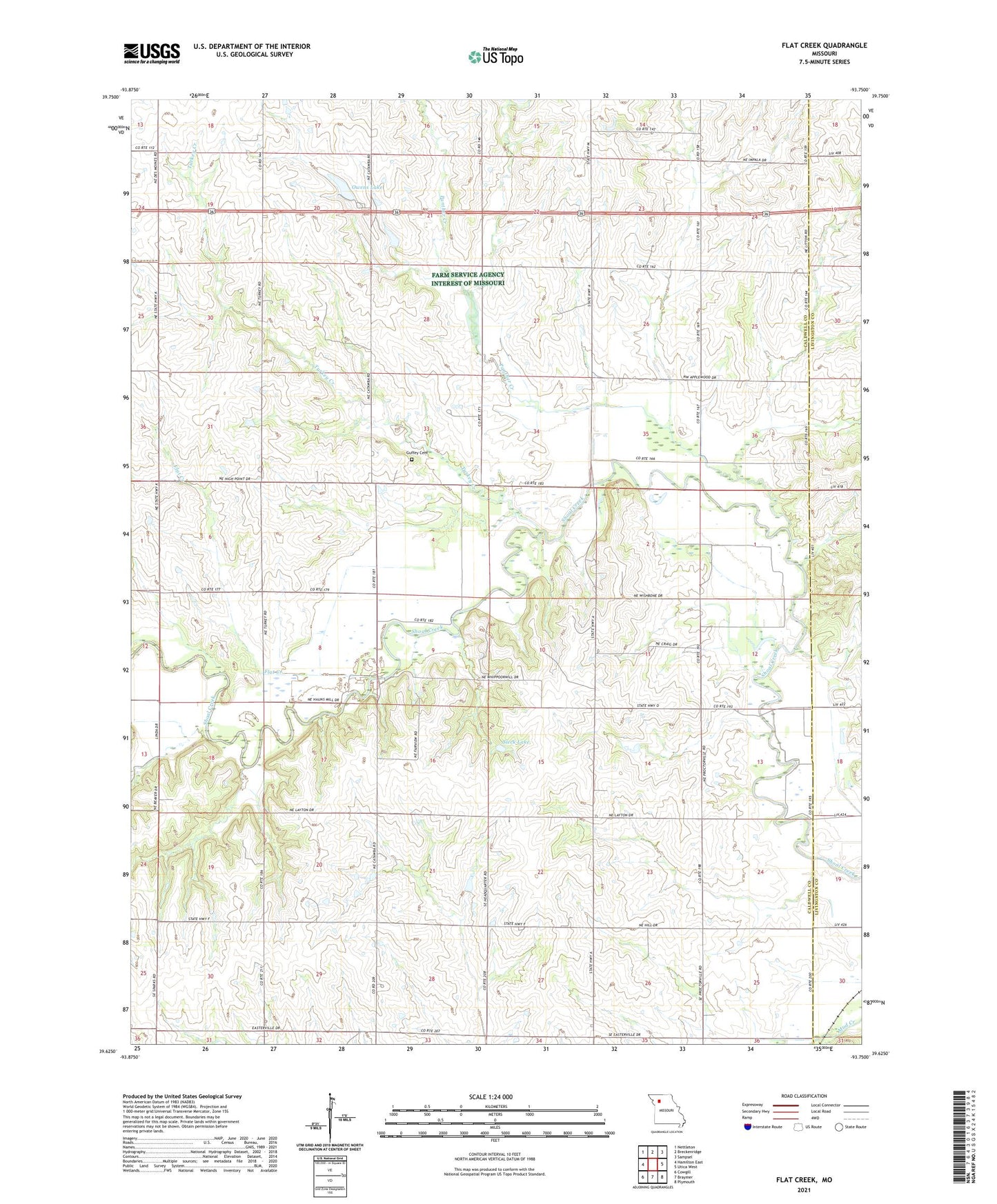
2021 topographic map quadrangle Flat Creek in the state of Missouri. Scale: 1:24000. Based on the newly updated USGS 7.5' US Topo map series, this map is in the following counties: Caldwell, Livingston. The map contains contour data, water features, and other items you are used to seeing on USGS maps, but also has updated roads and other features. This is the next generation of topographic maps. Printed on high-quality waterproof paper with UV fade-resistant inks.
Quads adjacent to this one:
West: Hamilton East
Northwest: Nettleton
North: Breckenridge
Northeast: Sampsel
East: Utica West
Southeast: Plymouth
South: Braymer
Southwest: Cowgill
This map covers the same area as the classic USGS quad with code o39093f7.
Contains the following named places: Braymer Lake, Catawba, Catawba School, Flat Creek, Grand View Church, Guffey Cemetery, Kampen Lake Section 20 Dam, Layton School, Locust Grove School, Niehaus Brothers Lake Dam, Number 167 Reservoir, Otter Creek, Owens Lake, Panther Creek, Proctorville, Proctorville School, Sieck Lake, Sieck Lake Dam, Township of Breckenridge, Township of Fairview, Turkey Creek, Turkey Creek School, Unity Chapel, Victory School, Wolf Grove School, Wright School, ZIP Code: 64625