MyTopo
Hamilton West Missouri US Topo Map
Couldn't load pickup availability
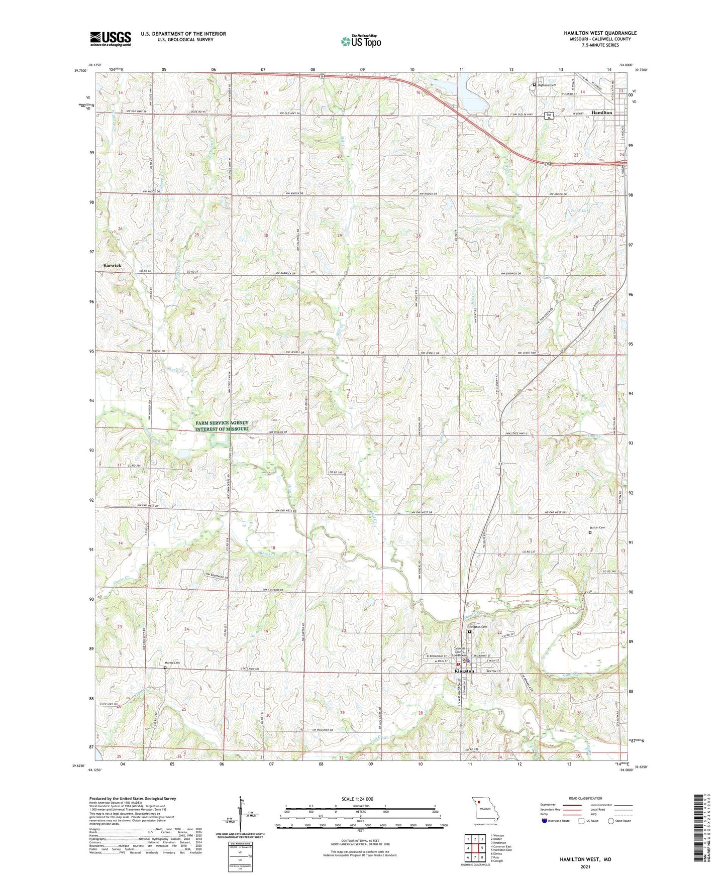
2021 topographic map quadrangle Hamilton West in the state of Missouri. Scale: 1:24000. Based on the newly updated USGS 7.5' US Topo map series, this map is in the following counties: Caldwell. The map contains contour data, water features, and other items you are used to seeing on USGS maps, but also has updated roads and other features. This is the next generation of topographic maps. Printed on high-quality waterproof paper with UV fade-resistant inks.
Quads adjacent to this one:
West: Cameron East
Northwest: Winston
North: Kidder
Northeast: Nettleton
East: Hamilton East
Southeast: Cowgill
South: Polo
Southwest: Elmira
This map covers the same area as the classic USGS quad with code o39094f1.
Contains the following named places: Barwick, Barwick School, Caldwell County Sheriff's Office, Center Prairie School, City of Hamilton, City of Kingston, Clark Lake, Clark Lake Dam, Corner School, Dillon School, Dustin Cemetery, East Sheep Creek, Far West School, Goose Creek, Hamilton City Water Plant Dam, Hamilton Reservoir, Harrison School, Highland Cemetery, Houghton School, Independence School, Jim Creek, Kendall Church, Kingston, Kingston Cemetery, Kingston Elementary School, Kingston Fire Department, Kingston Post Office, Long Creek, Manson School, Mill Creek, Mill Creek School, Morris Cemetery, Sheep Creek, Township of Hamilton, Township of Kingston, West Prairie School, West Sheep Creek, ZIP Code: 64650