MyTopo
Curryville Missouri US Topo Map
Couldn't load pickup availability
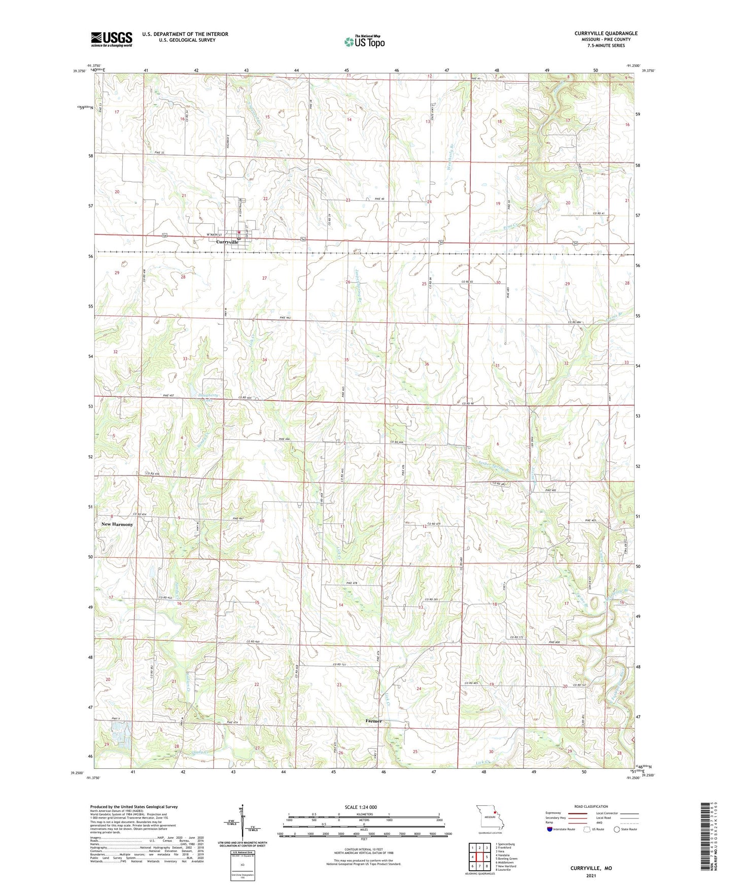
2021 topographic map quadrangle Curryville in the state of Missouri. Scale: 1:24000. Based on the newly updated USGS 7.5' US Topo map series, this map is in the following counties: Pike. The map contains contour data, water features, and other items you are used to seeing on USGS maps, but also has updated roads and other features. This is the next generation of topographic maps. Printed on high-quality waterproof paper with UV fade-resistant inks.
Quads adjacent to this one:
West: Vandalia
Northwest: Spencerburg
North: Frankford
Northeast: Vera
East: Bowling Green
Southeast: Louisville
South: New Hartford
Southwest: Middletown
Contains the following named places: Allison School, City of Curryville, Concord Church, Concord School, Cuivre Creek, Curryville, Curryville Elementary School, Curryville Police Department, Curryville Post Office, Curryville Volunteer Fire Department, Deigel Dam, Dougherty Lake, Dry Straw Branch, Excelsior School, Farmer, Irvine Branch, Jasper Spring Branch, Kilby Church, Marzolf, Marzolf Post Office, Murray Hill School, New Harmony, Sandy Creek, Shady Creek, Township of Indian, Vannoy School, Woodlawn School, ZIP Code: 63339