MyTopo
Bowling Green Missouri US Topo Map
Couldn't load pickup availability
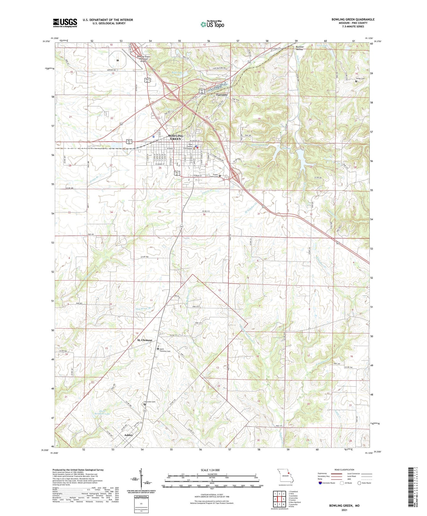
2021 topographic map quadrangle Bowling Green in the state of Missouri. Scale: 1:24000. Based on the newly updated USGS 7.5' US Topo map series, this map is in the following counties: Pike. The map contains contour data, water features, and other items you are used to seeing on USGS maps, but also has updated roads and other features. This is the next generation of topographic maps. Printed on high-quality waterproof paper with UV fade-resistant inks.
Quads adjacent to this one:
West: Curryville
Northwest: Frankford
North: Vera
Northeast: Louisiana
East: Cyrene
Southeast: Eolia
South: Louisville
Southwest: New Hartford
This map covers the same area as the classic USGS quad with code o39091c2.
Contains the following named places: Antioch Church, Ashley, Ashley Census Designated Place, Bibb Dam, Bibb Lake, Booth, Bowling Green, Bowling Green Elementary School, Bowling Green Fire Department, Bowling Green High School, Bowling Green Middle School, Bowling Green Municipal Airport, Bowling Green Police Department, Bowling Green Post Office, Bowling Green Reservoir, Bowling Green Reservoir Dam, Buckner Hollow, Buckner Hollow School, Champ Clark House, City of Bowling Green, Crow School, East Sulphur Creek, Ebers Brothers Dam, Ebers Brothers Lake, Fairview Cemetery, Faith Tabernacle, Green Lawn Cemetery, KPCR-AM (Bowling Green), KPCR-FM (Bowling Green), Middle Sulphur Creek, Miller School, Mound Prairie School, Northeast Correctional Center, Old Bowling Green Reservoir Dam, Old Lake, Paul Williams Dam, Pike County, Pike County Farm, Pike County Sheriff's Office, Saint Clement, Saint Clement Cemetery, Saint Clement Census Designated Place, Smith Cemetery, Tarrants, Township of Ashley, Township of Cuivre, Vera Lake, Vera Lake Dam, Village of Tarrants, ZIP Code: 63334