MyTopo
Frankford Missouri US Topo Map
Couldn't load pickup availability
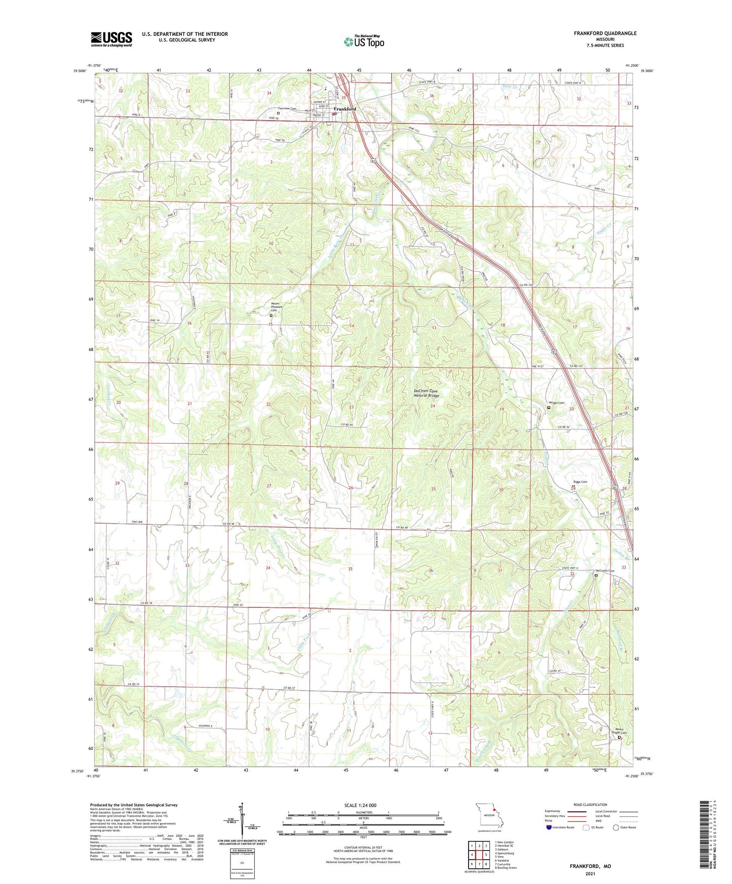
2021 topographic map quadrangle Frankford in the state of Missouri. Scale: 1:24000. Based on the newly updated USGS 7.5' US Topo map series, this map is in the following counties: Pike, Ralls. The map contains contour data, water features, and other items you are used to seeing on USGS maps, but also has updated roads and other features. This is the next generation of topographic maps. Printed on high-quality waterproof paper with UV fade-resistant inks.
Quads adjacent to this one:
West: Spencerburg
Northwest: New London
North: Hannibal SE
Northeast: Ashburn
East: Vera
Southeast: Bowling Green
South: Curryville
Southwest: Vandalia
This map covers the same area as the classic USGS quad with code o39091d3.
Contains the following named places: Biggs Cemetery, City of Frankford, Donovan School, DuChien Cave Natural Bridge, Fairview Cemetery, Frankford, Frankford Elementary School, Frankford Fire Department, Frankford Post Office, Gailey Branch, Gentle School, Hickory Grove School, Little Peno Creek, Martin School, McCune Post Office, McCune Railroad Station, McCunes Cemetery, Mount Air Church, Mount Pisgah Cemetery, Mount Pisgah Church, Mount Pleasant Cemetery, Oakdale School, Peno, Peno Church, Peno School, Railroad Branch, Ranacker State Wildlife Area, Steele School, Sunny Slope School, Township of Peno, Weatherly Branch, Wright Cemetery, ZIP Code: 63441