MyTopo
Elm Missouri US Topo Map
Couldn't load pickup availability
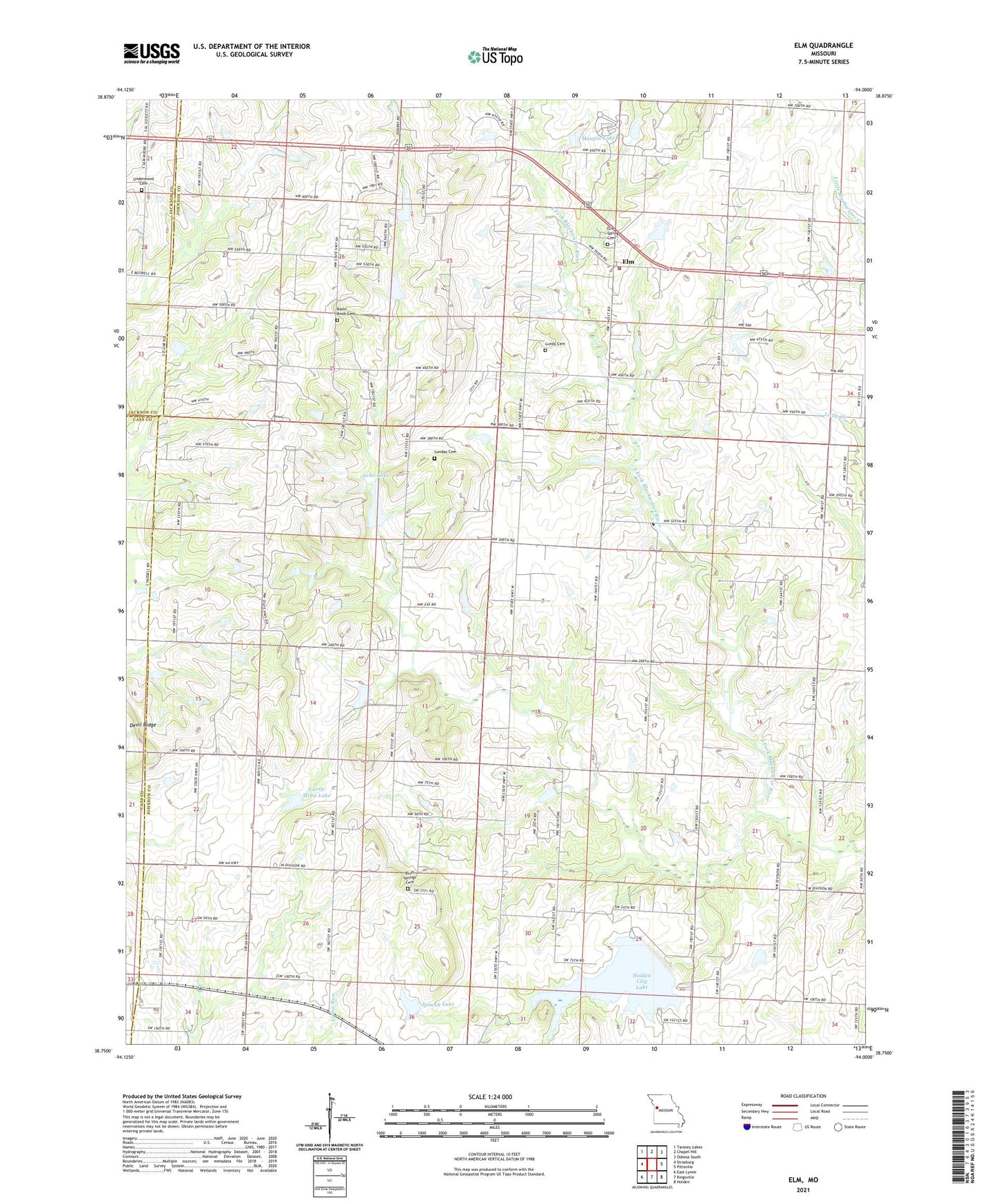
2021 topographic map quadrangle Elm in the state of Missouri. Scale: 1:24000. Based on the newly updated USGS 7.5' US Topo map series, this map is in the following counties: Johnson, Jackson, Cass. The map contains contour data, water features, and other items you are used to seeing on USGS maps, but also has updated roads and other features. This is the next generation of topographic maps. Printed on high-quality waterproof paper with UV fade-resistant inks.
Quads adjacent to this one:
West: Strasburg
Northwest: Tarsney Lakes
North: Chapel Hill
Northeast: Odessa South
East: Pittsville
Southeast: Holden
South: Kingsville
Southwest: East Lynne
Contains the following named places: Basin Knob Cemetery, Basin Knob School, Bluff Springs Cemetery, Burk School, Carey Mims Dam, Carey Mims Lake, Devil Ridge, East Branch South Fork Blackwater River Watershed Dam B-19, East Branch South Fork Blackwater River Watershed Dam C-15, East Branch South Fork Blackwater River Watershed Number E-24 Dam, Echo Lake, Elm, Elm Spring Cemetery, Everett School, Forest Grove Church, Fulkerson, Fulkerson Post Office, Holden City Lake, Holden Water Supply Dam, Howard School, Johnson County A-26 Dam, Johnson County Fire Protection District 2 Station 5 Elm, Johnson Number A-1 Dam, Knapp Lake Dam, Lincoln School, Lone Walnut School, Lunday Cemetery, Lundy Cemetery, Maupin Lake, Maupin Lake Dam, Seventh Day Adventist Church, South Fork Blackwater River Watershed Dam A-20, South Fork Blackwater River Watershed Dam A-21, Spiwak Lake, Township of Jackson, Underwood Cemetery, Wesley Chapel, ZIP Code: 64061