MyTopo
East Lynne Missouri US Topo Map
Couldn't load pickup availability
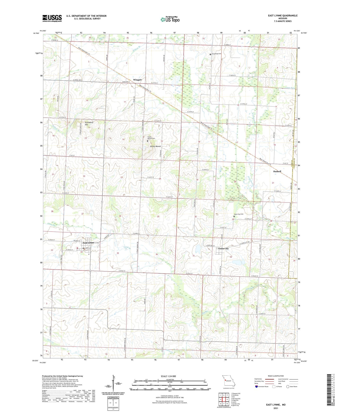
2021 topographic map quadrangle East Lynne in the state of Missouri. Scale: 1:24000. Based on the newly updated USGS 7.5' US Topo map series, this map is in the following counties: Cass, Johnson. The map contains contour data, water features, and other items you are used to seeing on USGS maps, but also has updated roads and other features. This is the next generation of topographic maps. Printed on high-quality waterproof paper with UV fade-resistant inks.
Quads adjacent to this one:
West: Harrisonville
Northwest: Pleasant Hill
North: Strasburg
Northeast: Elm
East: Kingsville
Southeast: Quick City
South: Garden City
Southwest: Austin
This map covers the same area as the classic USGS quad with code o38094f2.
Contains the following named places: Cause Prairie, City of East Lynne, Clear Creek, Crawford Creek, Daugherty School, East Lynne, East Lynne Elementary School, East Lynne Post Office, German Town School, Gunn City, Gunn City Cemetery, Gunn City Fire Department, Gunn City School, Hadsell, Hapke Lake, Hapke Lake Dam, Hereford Lake, Hereford Lake Dam, Jim Kircher Dam, Kircher Lake, Kircher P D Dam, Kirchers Upper Lake, Louse Run, Marshall School, Meher Lake, Mehrer Lake Dam, Oviet, Roth Farms Airport, Roth Farms Lake Dam, Roth Lake, Roth Lake Dam, Schindorff Hill, Schrock Lake Dam, Shingleton Lake, Shingleton Lake Dam, Smith School, Staley Mound, Staley Mound Cemetery, Strasburg Cemetery, Township of Camp Branch, Village of Gunn City, Willow Branch, Wingate, Wingate School, Young Lake, Young Lake Dam, ZIP Code: 64743