MyTopo
Guthrie Missouri US Topo Map
Couldn't load pickup availability
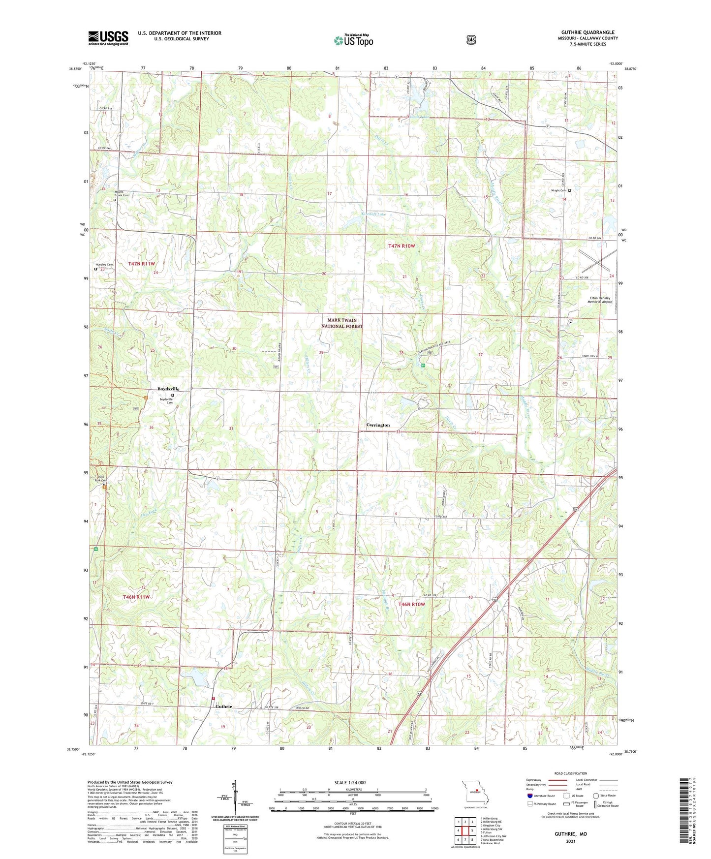
2021 topographic map quadrangle Guthrie in the state of Missouri. Scale: 1:24000. Based on the newly updated USGS 7.5' US Topo map series, this map is in the following counties: Callaway. The map contains contour data, water features, and other items you are used to seeing on USGS maps, but also has updated roads and other features. This is the next generation of topographic maps. Printed on high-quality waterproof paper with UV fade-resistant inks.
Quads adjacent to this one:
West: Millersburg SW
Northwest: Millersburg
North: Millersburg NE
Northeast: Kingdom City
East: Fulton
Southeast: Mokane West
South: New Bloomfield
Southwest: Jefferson City NW
Contains the following named places: Althiser Lake Dam, Baker School, Boydsville, Boydsville Cemetery, Carrington, Carrington Pits Picnic Area, Carrington School, Cedar Creek Purchase Unit, Central Church, Central School, Davis Creek, Davis Lake Dam, Dry Fork Church, Dry Fork School, Duley School, Elton Hensley Memorial Airport, Eve Lake Dam, Filmore School, Guthrie, Hundley Cemetery, Kirchoff Lake, Middle River School, Millers Creek Cemetery, Millers Creek Church, New Bloomfield Fire Protection District, Paris Fork Cemetery, Paris Fork Church, Reed Lake Dam, Reeds Lake, Reeds Lake Dam, Shady Grove School, Township of Guthrie, Township of Round Prairie, Wright Cemetery