MyTopo
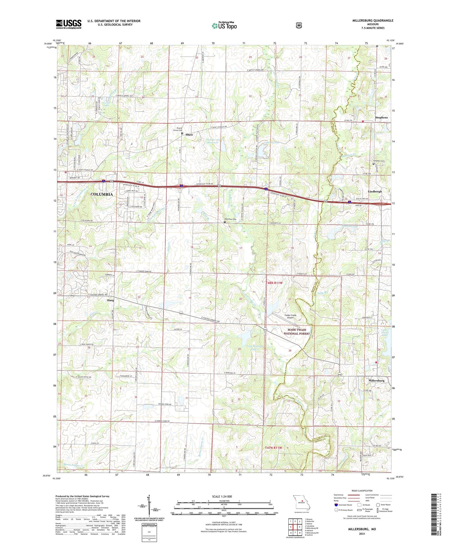
Millersburg Missouri US Topo Map
Couldn't load pickup availability
Also explore the Millersburg Forest Service Topo of this same quad for updated USFS data
2021 topographic map quadrangle Millersburg in the state of Missouri. Scale: 1:24000. Based on the newly updated USGS 7.5' US Topo map series, this map is in the following counties: Boone, Callaway. The map contains contour data, water features, and other items you are used to seeing on USGS maps, but also has updated roads and other features. This is the next generation of topographic maps. Printed on high-quality waterproof paper with UV fade-resistant inks.
Quads adjacent to this one:
West: Columbia
Northwest: Browns
North: Hallsville
Northeast: Hatton
East: Millersburg NE
Southeast: Guthrie
South: Millersburg SW
Southwest: Ashland
This map covers the same area as the classic USGS quad with code o38092h2.
Contains the following named places: Allen Cemetery, Bone Branch, Boone County Fire Protection District Station 1, Boonesborough, Carter School, Cedar Church, Cedar Creek Airport, Cheng Lake Dam, Corns Lake, Daly Dam, Gillaspy School, Hamilton Cemetery, Harg, Jacobs School, KOPN-FM (Columbia), Lake Chateau Dam, Lake Lavista, Lake Lavista Dam, Lake of the Woods Recreation Area, Landhuis Lake, Landhuis Lake Dam, Lindbergh, Little Cedar Creek, Manacle Chapel, Manacle Creek, McGuire School, Millersburg Fire Protection District, Millersburg School, Newman Lake, Newman Lake Number 2 Dam, North Callaway Fire Protection District Station 4, Number 153 Reservoir, Olivet Church, Prairie Grove Cemetery, Prairie Grove Church, Robnett School, Sally Branch, Shaw, Simpson Cemetery, Simpson Chapel, Stephens, Stephens School, Stephens Store, Township of Columbia, Troy Newman Lake 1, Truitt School, Turkey Farm Lake Dam, Turner School, Welch Lake Dam, ZIP Code: 65201