MyTopo
Hancock Missouri US Topo Map
Couldn't load pickup availability
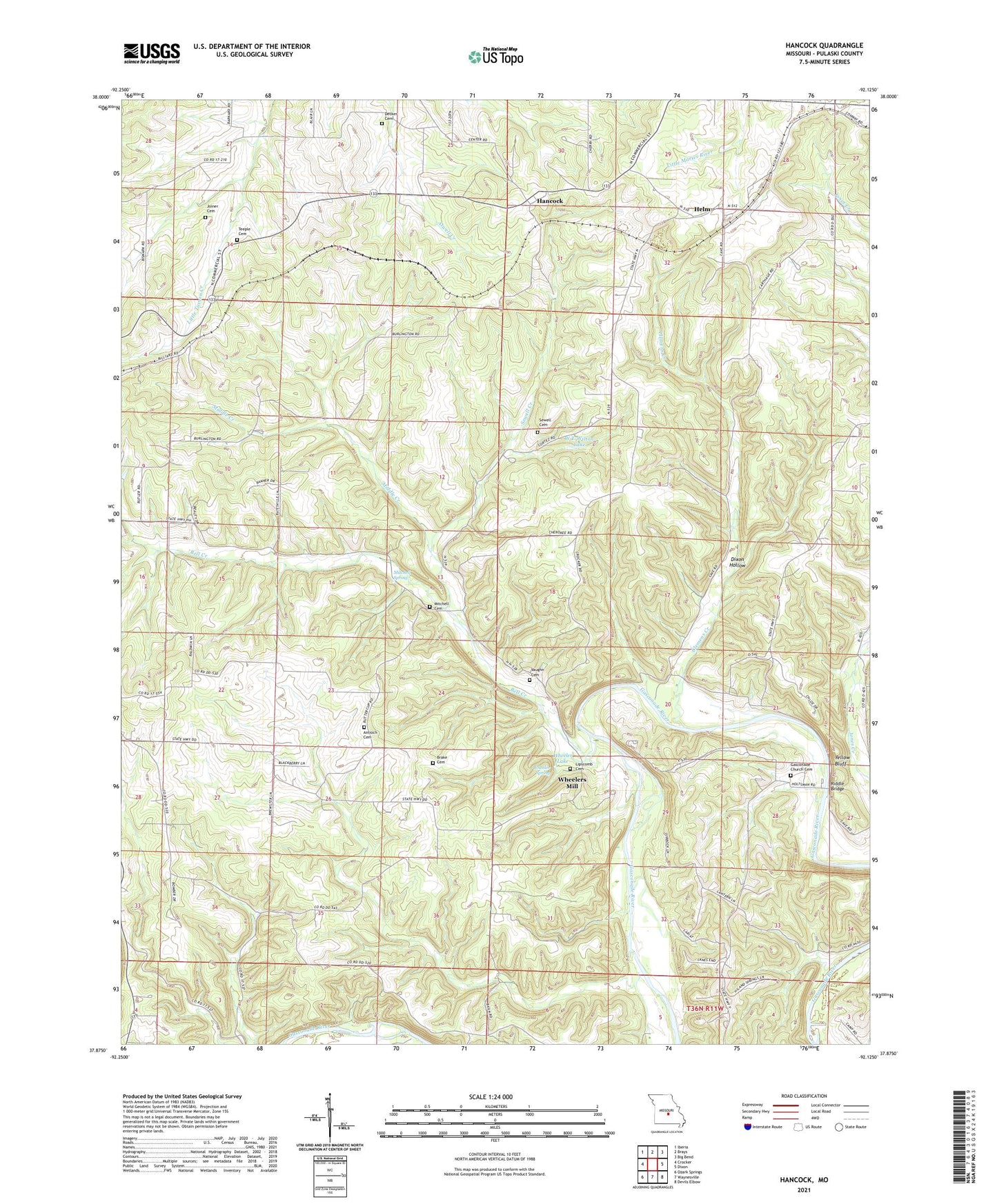
2021 topographic map quadrangle Hancock in the state of Missouri. Scale: 1:24000. Based on the newly updated USGS 7.5' US Topo map series, this map is in the following counties: Pulaski. The map contains contour data, water features, and other items you are used to seeing on USGS maps, but also has updated roads and other features. This is the next generation of topographic maps. Printed on high-quality waterproof paper with UV fade-resistant inks.
Quads adjacent to this one:
West: Crocker
Northwest: Iberia
North: Brays
Northeast: Big Bend
East: Dixon
Southeast: Devils Elbow
South: Waynesville
Southwest: Ozark Springs
Contains the following named places: Antioch Cemetery, Bates School, Bell Creek, Brake Cemetery, Brown School, Clemens Creek, Cowan School, Decker Cemetery, Dixon Hollow, Dixon Lookout Tower, Gasconade Church Cemetery, Hamilton School, Hancock, Helm, Joiner Cemetery, Jury Siding, Lipscomb Cemetery, Middle Creek, Mitchell Chapel Cemetery, Mitchell Church, Mitchell Spring, Needmore Mission, Needmore School, Rhodes Spur, Riddle Bridge, Sewell Cemetery, Sewell Creek, Shady Rest, Sweet Home Church, Sweet Home School, Teeple Cemetery, Underwood Place, Vaughan Cemetery, W E Wilton Dam, W E Wilton Lake, Wheeler Lake, Wheeler Resort, Wheeler Spring, Wheelers Mill, Yellow Bluff, Yellow Bluff Cottages