MyTopo
Hardin Missouri US Topo Map
Couldn't load pickup availability
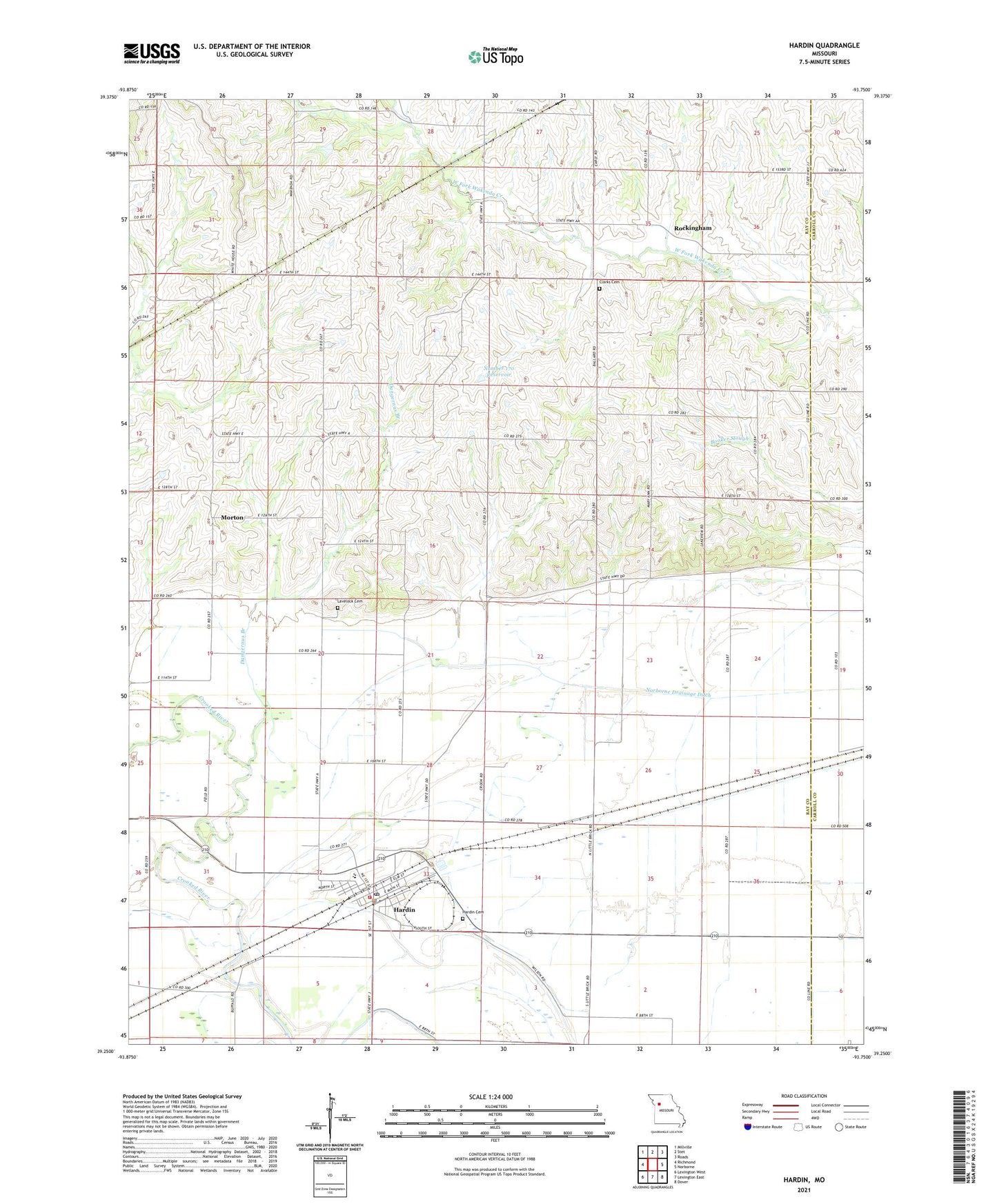
2021 topographic map quadrangle Hardin in the state of Missouri. Scale: 1:24000. Based on the newly updated USGS 7.5' US Topo map series, this map is in the following counties: Ray, Carroll. The map contains contour data, water features, and other items you are used to seeing on USGS maps, but also has updated roads and other features. This is the next generation of topographic maps. Printed on high-quality waterproof paper with UV fade-resistant inks.
Quads adjacent to this one:
West: Richmond
Northwest: Millville
North: Stet
Northeast: Roads
East: Norborne
Southeast: Dover
South: Lexington East
Southwest: Lexington West
Contains the following named places: Carpenter Airport, City of Hardin, Clarks Cemetery, Dangerous Branch, Hardin, Hardin - Central Elementary School, Hardin - Central High School, Hardin Cemetery, Hardin Fire Protection District, Hardin Police Department, Hardin Post Office, Lakeview, Lakeview Post Office, Lakeview School, Lavelock Cemetery, Liberty Church, Little Brick School, Morton, Mount Pleasant Church, Nimrod, Number 170 Dam, Number 170 Reservoir, Oyler Lake Dam, Plum Grove School, Rife School, Rockingham, Shakeford School, Township of Crooked River, Wakenda Church, Waller Lake Dam, ZIP Code: 64035