MyTopo
Richmond Missouri US Topo Map
Couldn't load pickup availability
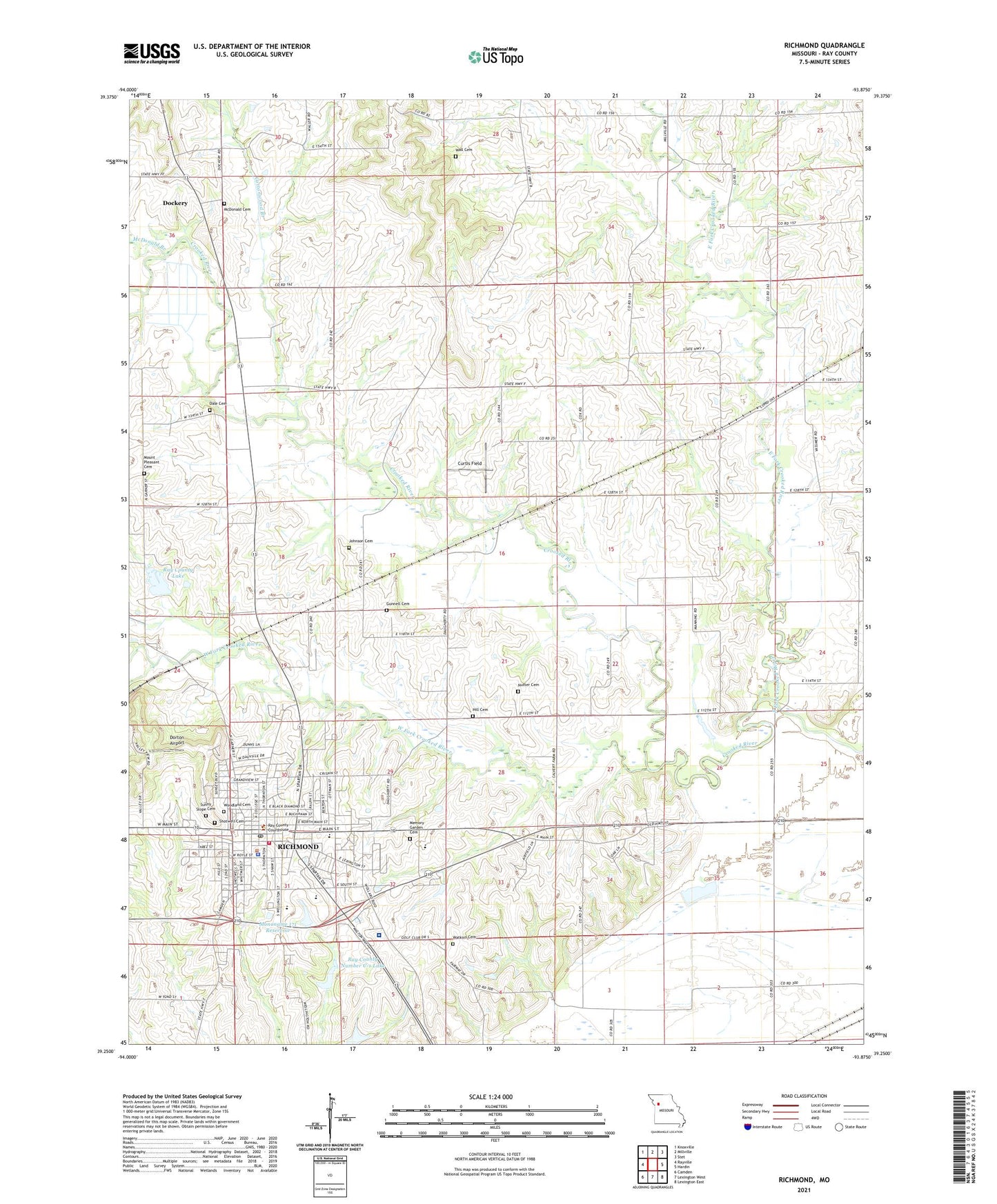
2021 topographic map quadrangle Richmond in the state of Missouri. Scale: 1:24000. Based on the newly updated USGS 7.5' US Topo map series, this map is in the following counties: Ray. The map contains contour data, water features, and other items you are used to seeing on USGS maps, but also has updated roads and other features. This is the next generation of topographic maps. Printed on high-quality waterproof paper with UV fade-resistant inks.
Quads adjacent to this one:
West: Rayville
Northwest: Knoxville
North: Millville
Northeast: Stet
East: Hardin
Southeast: Lexington East
South: Lexington West
Southwest: Camden
This map covers the same area as the classic USGS quad with code o39093c8.
Contains the following named places: Blue Jay School, Bryant School, City of Richmond, Cottonwood Branch, Curtis Field, Dale Cemetery, Dear Elementary School, Dockery, Dockery Cemetery, Dorton Airport, East Fork Crooked River, Gunnell Cemetery, Hamilton and Hill Farm Lake Dam, Hickory Grove Church, Hill Cemetery, Hill School, Johnson Cemetery, Liberty School, Lincoln School, McDonald Branch, Memory Garden Cemetery, Mononame 171 Reservoir, Mount Pleasant Cemetery, Nutter Cemetery, Nutter School, Patton School, Prairie Valley School, Ray County, Ray County Dam C-21, Ray County Dam Number C-1, Ray County Lake, Ray County Lake Dam, Ray County Memorial Hospital, Ray County Number C-1 Lake, Ray County Number C-21 Lake, Richmond, Richmond Fire Department, Richmond High School, Richmond Intermediate School, Richmond Middle School, Richmond Police Department, Richmond Post Office, Richmond Schools Dam, Roberts Park, Shirkey Recreation Park Lake Dam, Shotwell Cemetery, Sunny Slope Cemetery, Timber Ridge School, Township of Richmond, Wall Cemetery, Watkins Cemetery, West Fork Crooked River, West Ward School, Woodland Cemetery, ZIP Code: 64085