MyTopo
Lexington West Missouri US Topo Map
Couldn't load pickup availability
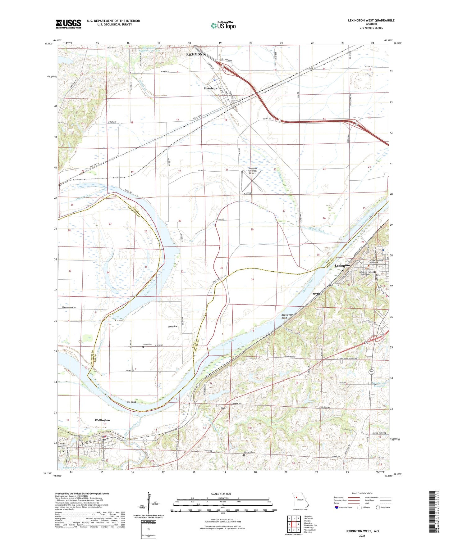
2021 topographic map quadrangle Lexington West in the state of Missouri. Scale: 1:24000. Based on the newly updated USGS 7.5' US Topo map series, this map is in the following counties: Ray, Lafayette. The map contains contour data, water features, and other items you are used to seeing on USGS maps, but also has updated roads and other features. This is the next generation of topographic maps. Printed on high-quality waterproof paper with UV fade-resistant inks.
Quads adjacent to this one:
West: Camden
Northwest: Rayville
North: Richmond
Northeast: Hardin
East: Lexington East
Southeast: Mayview
South: Odessa North
Southwest: Bates City
This map covers the same area as the classic USGS quad with code o39093b8.
Contains the following named places: Bootlegger Bend, City of Henrietta, City of Wellington, Cravens Creek, Dam A-21 Dam, Foster Cemetery, Glenwood School, Graddy Mine, Henrietta, Henrietta Post Office, Hollingsworth Lake Dam, Lafayette County Sheriff's Office, Lafayette Regional Health Center, Lafayette Village Shopping Center, Lexington, Lexington Battle Ground, Lexington Fire and Rescue Department, Lexington Municipal Airport, Lexington Post Office, Lexington School District Student Success Center, Linden School, Little Sni-A-Bar Creek, Little Sni-A-Bar Watershed Structure Number 21 Dam, Little Sni-A-Bar Watershed Structure Number 22 Dam, Little Sni-A-Bar Watershed Structure Number 23 Dam, Little Sni-A-Bar Watershed Structure Number 47 Dam, Macedonia Church, Macedonia School, Marshall School, Martin - Carr Cemetery, Mitchell Cemetery, Myrick, Ray County Dam Number A-1, Ray County Sheriff's Office, Richmond Water Works, Sni Bend, Sni-A-Bar Creek, Sunshine, Sunshine Drain, Sunshine Lake, Sunshine School, Wellington, Wellington - Napoleon Elementary School, Wellington - Napoleon Fire Protection District, Wellington - Napoleon High School, Wellington City Cemetery, Wellington Police Department, Wellington Post Office, Wellington-Napoleon Watershed Structure B-21 Dam, Willow Creek, ZIP Code: 64036