MyTopo
Hartsburg Missouri US Topo Map
Couldn't load pickup availability
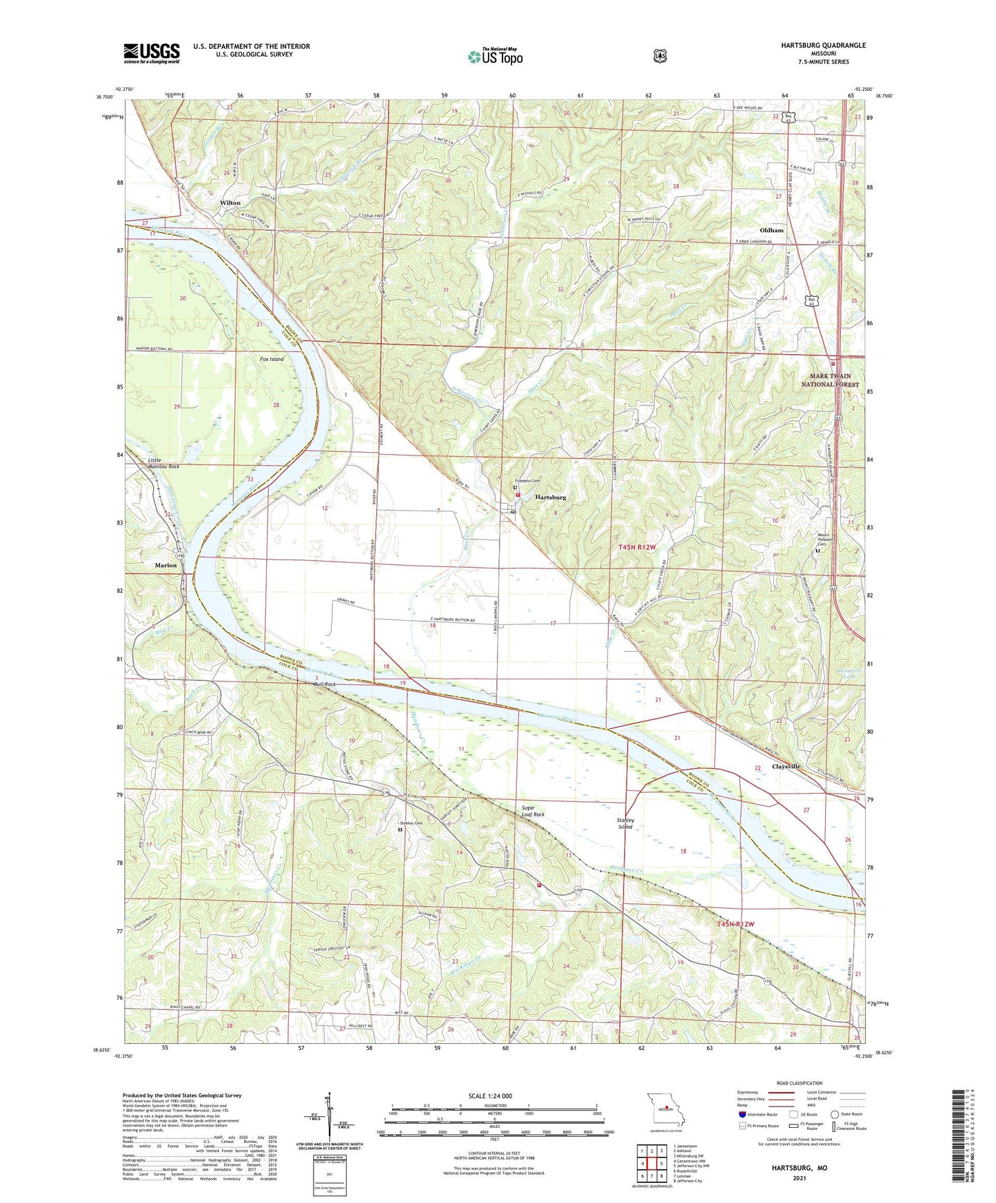
2021 topographic map quadrangle Hartsburg in the state of Missouri. Scale: 1:24000. Based on the newly updated USGS 7.5' US Topo map series, this map is in the following counties: Boone, Cole. The map contains contour data, water features, and other items you are used to seeing on USGS maps, but also has updated roads and other features. This is the next generation of topographic maps. Printed on high-quality waterproof paper with UV fade-resistant inks.
Quads adjacent to this one:
West: Centertown NW
Northwest: Jamestown
North: Ashland
Northeast: Millersburg SW
East: Jefferson City NW
Southeast: Jefferson City
South: Lohman
Southwest: Russellville
Contains the following named places: Arnold School, Bonds Chapel, Bonne Femme Creek, Bull Rock, Burlington, Central Missouri Correction Center, Christian School, Church Farm Lake Dam, Claysville, Concord School, Crenshaw School, Dead Creek, Demarco Lake Dam, Eureka, Fox Island, Friedens Cemetery, Glascock Branch, Grider Branch, Hart Creek, Hartsburg, Hartsburg Baptist Church, Hartsburg Post Office, Jemerson Creek, Joe Wren School, Kings Chapel, Kings Chapel School, Little Manitou Rock, Little Manitou Rocks, Lubker Dam, Marion, McKinney, Meadows Creek, Moniteau Creek, Mount Pleasant Cemetery, Mount Pleasant Church, Mud Creek, Oldham, Peace United Church of Christ, Pleasant Grove School, Regional West Fire Protection District Station 5, Rock Creek, Slate Creek, Southern Boone County Fire Protection District Station 18, Southern Boone County Fire Protection District Station 20, Stanley Island, Steeley Cemetery, Stonesport, Sugar Loaf Rock, Town of Hartsburg, Township of Cedar, Township of Marion, Wilton, Wilton School, Workman Creek, ZIP Code: 65039