MyTopo
Russellville Missouri US Topo Map
Couldn't load pickup availability
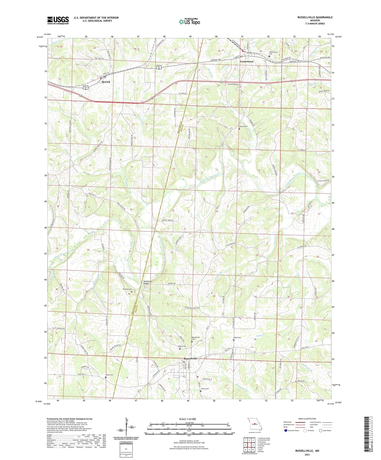
2021 topographic map quadrangle Russellville in the state of Missouri. Scale: 1:24000. Based on the newly updated USGS 7.5' US Topo map series, this map is in the following counties: Cole, Moniteau. The map contains contour data, water features, and other items you are used to seeing on USGS maps, but also has updated roads and other features. This is the next generation of topographic maps. Printed on high-quality waterproof paper with UV fade-resistant inks.
Quads adjacent to this one:
West: California South
Northwest: California North
North: Centertown NW
Northeast: Hartsburg
East: Lohman
Southeast: Brazito
South: Enon
Southwest: Olean
This map covers the same area as the classic USGS quad with code o38092e4.
Contains the following named places: Belleville, Blank Cemetery, Blank Ford, Brick School, California Rural Fire Protection District Mc Girk Fire Station, Centertown, Centertown Cemetery, Centertown Post Office, City of Russellville, Cliffty Branch, Cole R-1 Elementary School, Cole R-1 Middle School, Cole Spring Church, Enloe Cemetery, Johnson School, Kaley Ford, McGirk, Mount Hope School, Mount Pleasant School, Murray Cemetery, Regional West Fire Protection District Station 1, Rockhouse Bridge, Russellville, Russellville - Lohman Fire Protection District Station 1 Headquarters, Russellville Cemetery, Russellville High School, Russellville Post Office, Shock Ford, Strobel Branch, Surprise School, Town of Centertown, Township of Moreau, Trinity Cemetery, Van Pool Branch, Van Pool Cemetery, Van Pool School, Westing Branch, Wieneke Branch, Wilson Cemetery, ZIP Code: 65053