MyTopo
Ashland Missouri US Topo Map
Couldn't load pickup availability
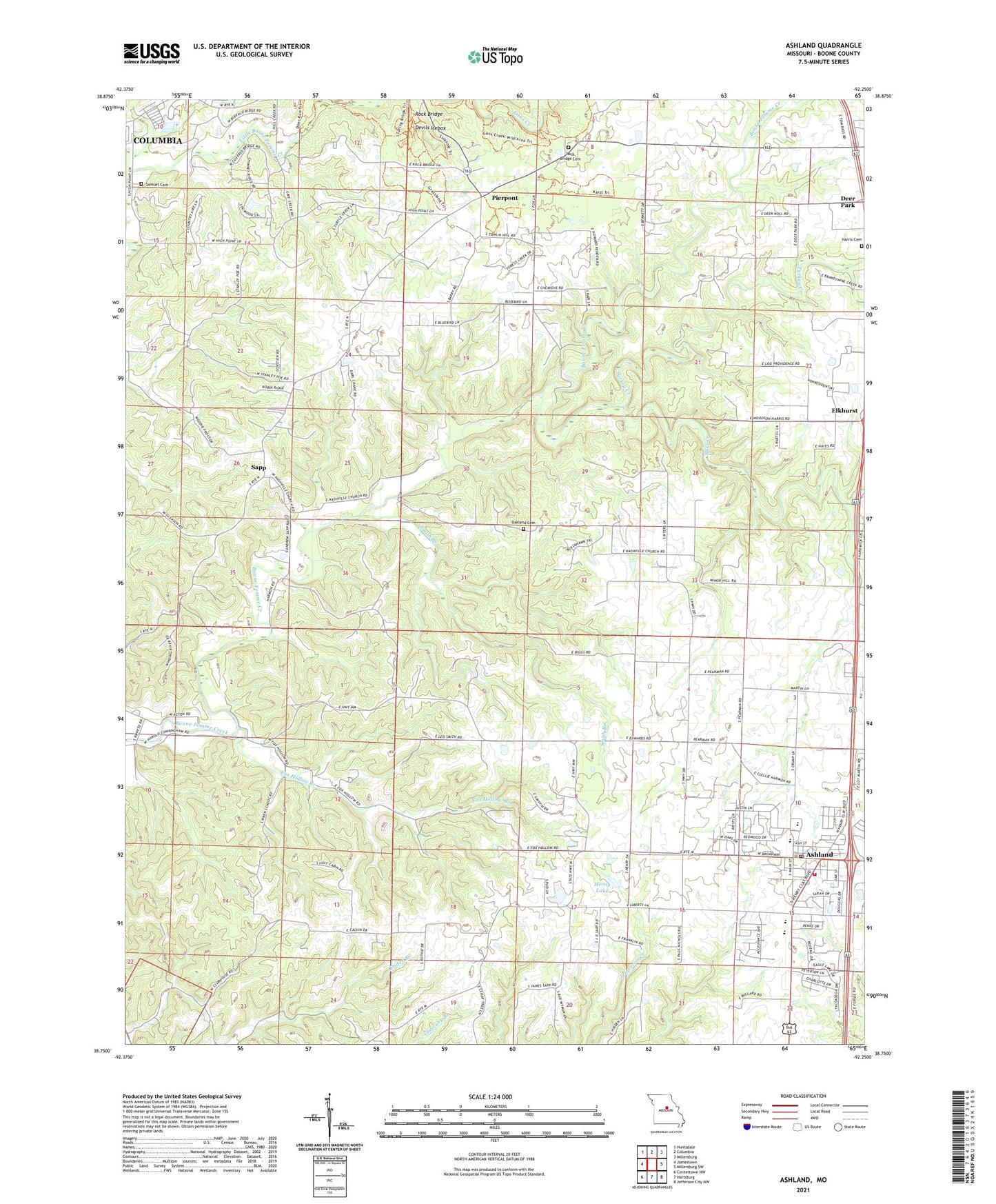
2021 topographic map quadrangle Ashland in the state of Missouri. Scale: 1:24000. Based on the newly updated USGS 7.5' US Topo map series, this map is in the following counties: Boone. The map contains contour data, water features, and other items you are used to seeing on USGS maps, but also has updated roads and other features. This is the next generation of topographic maps. Printed on high-quality waterproof paper with UV fade-resistant inks.
Quads adjacent to this one:
West: Jamestown
Northwest: Huntsdale
North: Columbia
Northeast: Millersburg
East: Millersburg SW
Southeast: Jefferson City NW
South: Hartsburg
Southwest: Centertown NW
This map covers the same area as the classic USGS quad with code o38092g3.
Contains the following named places: Ashland, Ashland Police Department, Ashland Post Office, Bass Creek, Cave Creek, Chariton River Hills, Charles W Green State Wildlife Management Area, Deer Park, Deer Park School, Devils Icebox, Elkhurst, Fox Hollow Branch, Harris Cemetery, Herny Dam, Herny Lake, Hill Creek Acres Lake Dam, Lakeview School, Log Providence Church, Nashville School, New Liberty Church, New Salem Church, Oakland Cemetery, Oakland School, Pauley School, Pierpont, Prospect School, Rock Bridge, Rock Bridge Cemetery, Samuel Cemetery, Sapp, Smith Branch, Southern Boone County Fire Protection District Station 17, Southern Boone Elementary School, Southern Boone High School, Southern Boone Middle School, Southern Boone Primary School, Township of Three Creeks, Turkey Creek, University of Missouri Environmental Health, Village of Pierpont, William Wren School