MyTopo
Hartshorn Missouri US Topo Map
Couldn't load pickup availability
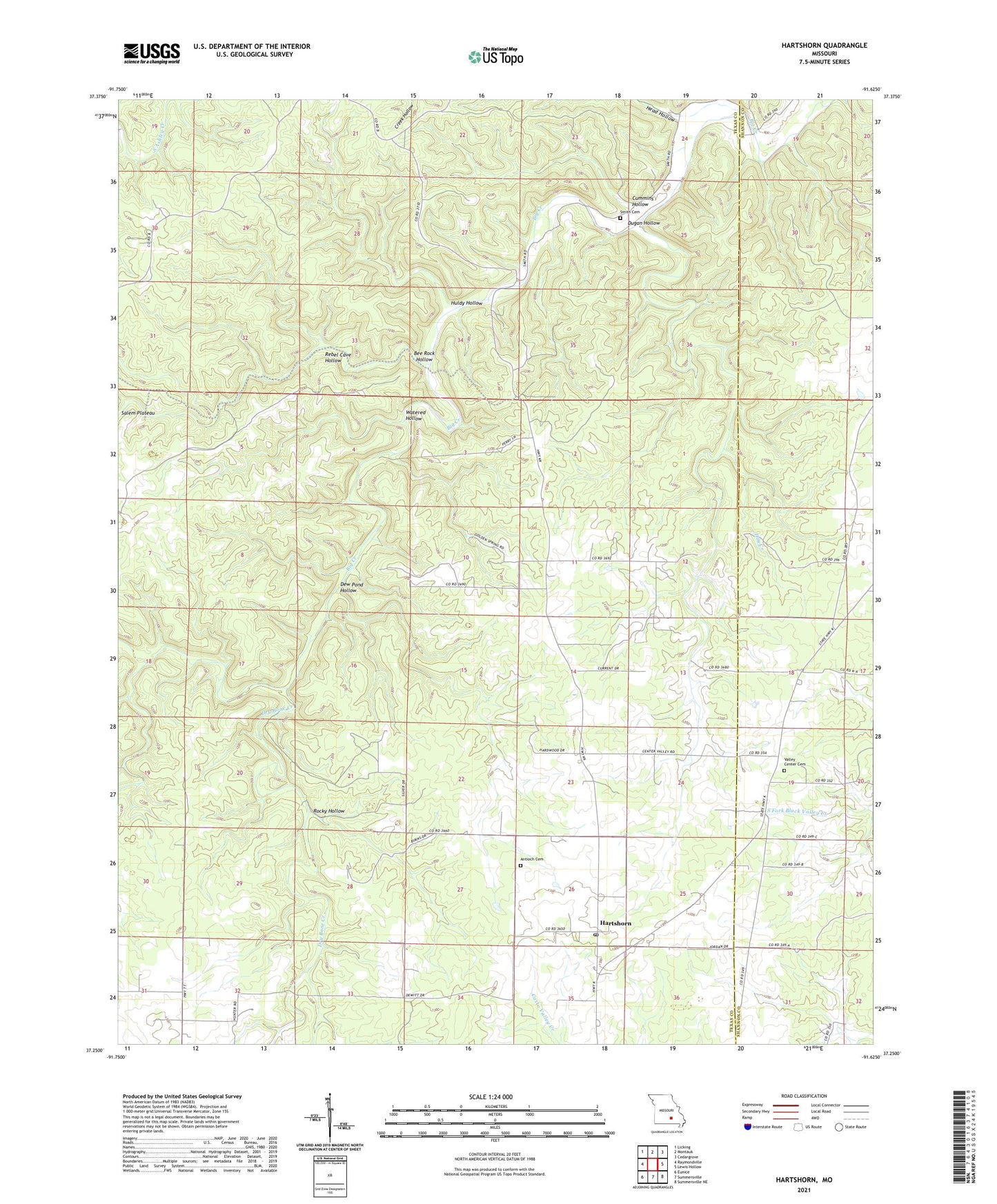
2021 topographic map quadrangle Hartshorn in the state of Missouri. Scale: 1:24000. Based on the newly updated USGS 7.5' US Topo map series, this map is in the following counties: Texas, Shannon. The map contains contour data, water features, and other items you are used to seeing on USGS maps, but also has updated roads and other features. This is the next generation of topographic maps. Printed on high-quality waterproof paper with UV fade-resistant inks.
Quads adjacent to this one:
West: Raymondville
Northwest: Licking
North: Montauk
Northeast: Cedargrove
East: Lewis Hollow
Southeast: Summersville NE
South: Summersville
Southwest: Eunice
This map covers the same area as the classic USGS quad with code o37091c6.
Contains the following named places: Antioch Cemetery, Bee Rock Hollow, Center Valley Church, Cummins Hollow, Dew Pond Hollow, Dry Bone Creek, Dugan Hollow, Hartshorn, Hay Creek, Huldy Hollow, Nile, Nile School, Pine Flats School, Rebel Cave Hollow, Rocky Hollow, Round Valley School, Salem Plateau, Smith Cemetery, Township of Current, Watered Hollow, ZIP Code: 65479