MyTopo
Hatton Missouri US Topo Map
Couldn't load pickup availability
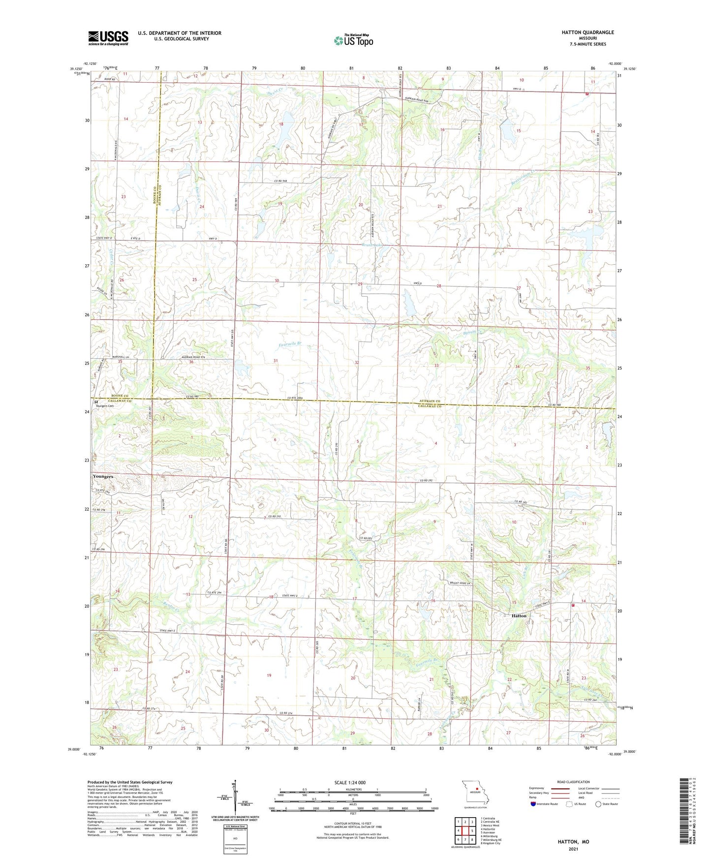
2021 topographic map quadrangle Hatton in the state of Missouri. Scale: 1:24000. Based on the newly updated USGS 7.5' US Topo map series, this map is in the following counties: Callaway, Audrain, Boone. The map contains contour data, water features, and other items you are used to seeing on USGS maps, but also has updated roads and other features. This is the next generation of topographic maps. Printed on high-quality waterproof paper with UV fade-resistant inks.
Quads adjacent to this one:
West: Hallsville
Northwest: Centralia
North: Centralia NE
Northeast: Mexico West
East: Auxvasse
Southeast: Kingdom City
South: Millersburg NE
Southwest: Millersburg
Contains the following named places: Bastian Lake Dam, Bruns Dam, Bruns Lake, Burke School, Cochran Dam, Faucett School, Feutz Airport, Feutz Lake, Feutz Lake West Dam, Flint School, Flynt School, Fourmile Branch, Fry School, Hatton, Hickory Grove Church, Hitt Branch, Hollander Dam, Lick Branch, Little Dixie Fire Protection District Station 2, Matthews Lake, North Callaway Fire Protection District Station 3, Oberlag Lake Dam, Offutt Dam, Offutt Lake, Pleasant Grove Church, Prater Dam North, Prater Dam South, Township of Liberty, Wade School, Walnut Grove School, Westminster Church, Williams Dam South Section 18, Williams Lake, Williams Section 18 North Dam, Youngers, Youngers Cemetery