MyTopo
Hendrickson Missouri US Topo Map
Couldn't load pickup availability
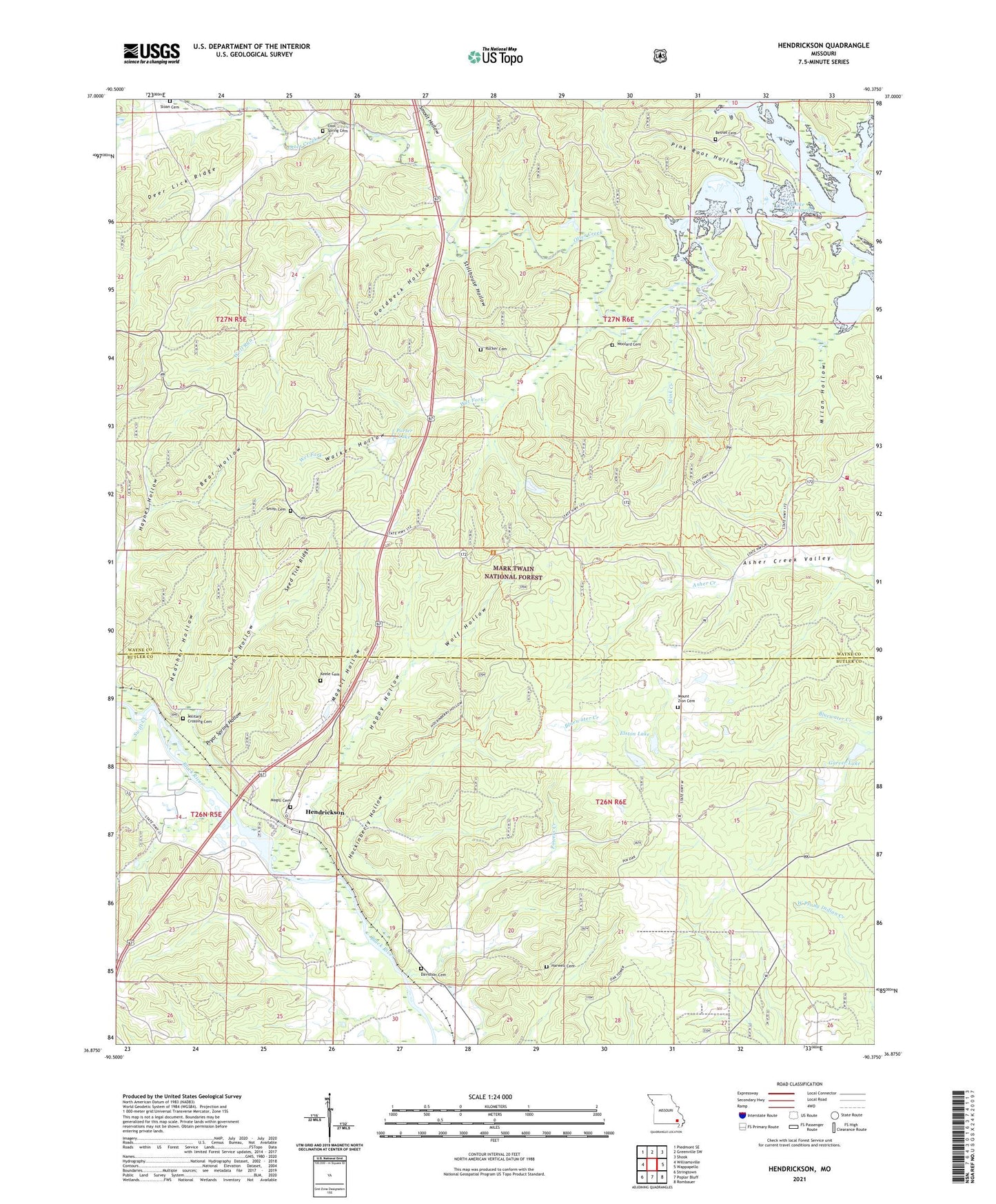
2021 topographic map quadrangle Hendrickson in the state of Missouri. Scale: 1:24000. Based on the newly updated USGS 7.5' US Topo map series, this map is in the following counties: Wayne, Butler. The map contains contour data, water features, and other items you are used to seeing on USGS maps, but also has updated roads and other features. This is the next generation of topographic maps. Printed on high-quality waterproof paper with UV fade-resistant inks.
Quads adjacent to this one:
West: Williamsville
Northwest: Piedmont SE
North: Greenville SW
Northeast: Shook
East: Wappapello
Southeast: Rombauer
South: Poplar Bluff
Southwest: Stringtown
Contains the following named places: Allison School, Asher Creek School, Barrett Mine, Barrett Switch, Bear Hollow, Bethel Cemetery, Bethel Church, Bethel School, Bluewater School, Butler County Fire Protection District Hendrickson Station, Chaonia Landing Launching Ramp, Chaonia Volunteer Fire Department, Collins Store, Cool Spring Cemetery, Cool Springs Church, Cool Springs School, Davidson Cemetery, Davidson School, Davidsons Mill, Deer Lick Ridge, Elston Dam, Elston Lake, Flatwoods Lookout Tower, Fox Den Mine, Garver Lake, Garver Lake Dam, Goldbeck Hollow, Happy Hollow, Harwell Cemetery, Heather Hollow, Hendrickson, Hockinberry Hollow, Kecher Gravel Pits, Kechers Ferry, Keele Cemetery, Ladero, Link Hollow, Magill Cemetery, Magill Ferry, Magill Hollow, Milan Hollow, Military Crossing Cemetery, Mink Creek, Mount Zion Cemetery, Mount Zion Church, Ojibway, Otter Creek, Perkins Branch, Pink Root Hollow, Pleasant Hill Church, Pleasant Hill School, Porter Dam, Porter Lake, Powers Creek, Pryor Spring Hollow, Rucker Cemetery, Rucker Church, Rucker School, Seed Tick Ridge, Sloan Cemetery, Smith Cemetery, Smoot Hollow, Stillhouse Hollow, Swift Creek, Taskee Church, Taskee Station, Taylor Mill, Township of Black River, Walker Hollow, Wet Fork, Wilsons Switch, Wolf Hollow, Wolf Run, Woolard Cemetery, ZIP Code: 63967