MyTopo
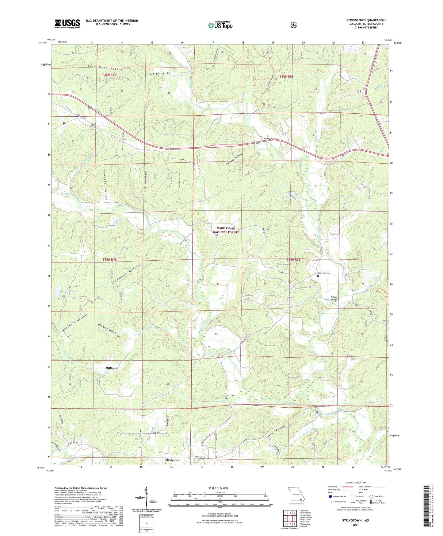
Stringtown Missouri US Topo Map
Couldn't load pickup availability
Also explore the Stringtown Forest Service Topo of this same quad for updated USFS data
2021 topographic map quadrangle Stringtown in the state of Missouri. Scale: 1:24000. Based on the newly updated USGS 7.5' US Topo map series, this map is in the following counties: Butler. The map contains contour data, water features, and other items you are used to seeing on USGS maps, but also has updated roads and other features. This is the next generation of topographic maps. Printed on high-quality waterproof paper with UV fade-resistant inks.
Quads adjacent to this one:
West: Hogan Hollow
Northwest: Ellsinore
North: Williamsville
Northeast: Hendrickson
East: Poplar Bluff
Southeast: Harviell
South: Fairdealing
Southwest: Flatwoods
This map covers the same area as the classic USGS quad with code o36090g5.
Contains the following named places: Bay Springs School, Beaver Lake, Bethel Chapel, Blue Hole Hollow, Butler County Fire Protection District Stringtown Station, Butler County Fire Protection District West Butler Station, Camp Branch, Cane Creek Church, Cane Creek School, Carlton Lake, Carlton Lake Dam, Crooked Branch, Eureka School, Everhart Hollow, Fletcher Branch, Garrettville Church, Gobbler Hollow, Good Hope Church, Goose Creek, Grassy Hollow, Halloran, Halloran School, Harmon Branch, Houts Cemetery, Hurricane Creek, Karls Lake, Karls Lake Lower Dam, Kerns Chapel, Mallady Hollow, Millers Bridge, Milltown, Nickey Bridge, Oak Ridge, Old Still Hollow, Pine Grove Camp, Procter Branch, Pry Chapel, Rushville Camp, Rushville School, Sears Youth Center, Smoky Hollow, Sparkman Cemetery, Stringtown, Tenmile Creek, Township of Epps, Victory School, Wet Slash Hollow