MyTopo
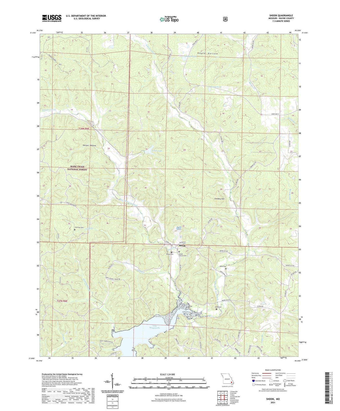
Shook Missouri US Topo Map
Couldn't load pickup availability
Also explore the Shook Forest Service Topo of this same quad for updated USFS data
2021 topographic map quadrangle Shook in the state of Missouri. Scale: 1:24000. Based on the newly updated USGS 7.5' US Topo map series, this map is in the following counties: Wayne. The map contains contour data, water features, and other items you are used to seeing on USGS maps, but also has updated roads and other features. This is the next generation of topographic maps. Printed on high-quality waterproof paper with UV fade-resistant inks.
Quads adjacent to this one:
West: Greenville SW
Northwest: Greenville
North: Lowndes
Northeast: Gipsy
East: McGee
Southeast: Puxico
South: Wappapello
Southwest: Hendrickson
This map covers the same area as the classic USGS quad with code o37090a3.
Contains the following named places: Blue Hole Branch, Childers Hill, Community Church, Davis School, East Fork Lost Creek, Flatwoods, Harper Hollow, Helm Cemetery, Hickory Flat Creek, Hickory Grove School, Jones Cemetery, Little Creek, Lost Creek Landing, Lottes Dam, Lottes Lake, Nagle Hollow, Pine Grove School, Reed Chapel, Round Pond, Scowden School, Shiloh Cemetery, Shiloh Church, Shook, Shook Creek, Spaugh Pond, Thornton Cemetery, Township of Lost Creek, West Fork Lost Creek, Yokum School, Yokum School State Wildlife Area, ZIP Codes: 63944, 63951